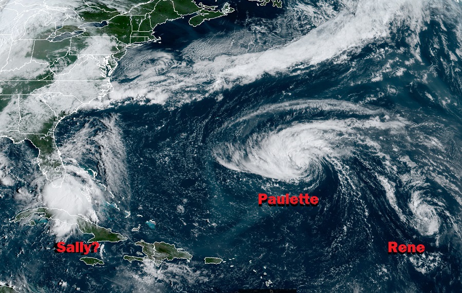
Hurricane and Tropical Storm Watches and Warnings are up ahead of potential landfalls of tropical cyclones Paulette and Tropical Depression #19 which is forecast to become Sally this weekend. While Rene continues to spin about over the open waters of the Central Atlantic, it appears other tropical cyclones could develop in the coming days too.
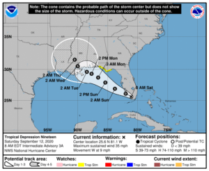
Tropical Depression #19 was located about 55 miles southeast of Naples, Florida at 8am this morning. With maximum sustained winds of 35 mph and a minimum central pressure of 1004 mb or 29.65 inches, the system is expected to complete its journey across south Florida today and emerge over the Gulf of Mexico. There, conditions are ripe for additional strengthening and this tropical cyclone is forecast by the National Hurricane Center to become a tropical storm later today or tonight. When it becomes a tropical storm, it will be named Sally and will become the earliest “S” storm to form on record in the basin.

A Tropical Storm Watch is in effect for from the Ochlockonee River to the Okaloosa / Walton County Line in Florida. A Tropical Storm Watch means that tropical storm conditions are possible within the watch area within the next 48 hours. The National Hurricane Center says interests elsewhere along the northern Gulf Coast should monitor the progress of this system. Tropical storm or hurricane watches could be issued for a portion of that area later today.
For now, it appears this system will move over the southeastern and eastern Gulf of Mexico later today and Sunday, and then move over the north-central Gulf of Mexico Sunday night and Monday. Strengthening is expected when the center moves over the Gulf of Mexico, and the depression is expected to become a tropical storm later today or tonight and gradually intensify Sunday and Monday. It is possible this storm could become a hurricane before landfall.
This system will bring gusty winds, heavy rain, rough surf, and the threat of tornadoes to the Gulf states over the next few days.
Tropical storm force winds are possible in the watch area in the Florida Panhandle by tomorrow night. Wind gusts to tropical storm force are possible across the southern portion of the Florida peninsula today.
Rainfall amounts of 2-4″ with isolated 6″ amounts are expected across west-central and southern Florida, including the Florida Keys, through Sunday. This rainfall may produce scattered flash flooding and prolong high flows and ongoing minor flooding on rivers across Central Florida. 2-4″ with isolated 6″ amounts is also expected across portions of the central Gulf Coast Sunday through Tuesday morning; flooding could become problematic there too.
Swells are expected to spread northward along the west-central coast of Florida and the Florida Panhandle during the next couple of days. These swells are likely to cause life-threatening surf and rip current conditions. Even experienced swimmers and surfers should stay out of the water until the storm threat has passed.
As with many landfalling tropical cyclone scenarios, a few tornadoes are possible today and tonight over southern Florida and more are likely over the central Gulf Coast as the storm makes landfall there.
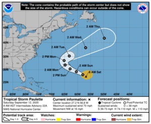
While the United States is dealing with what’ll likely be Sally soon, Bermuda is preparing for a direct impact from Paulette. Tropical Storm Paulette is moving northwestward over the central Atlantic and is forecast to bring hazardous conditions to Bermuda by tomorrow night.

Paulette’s maximum sustained winds are at 70 mph now, making it a strong tropical storm. It is likely to strengthen to a hurricane later today or tonight.
Due to the expected impacts from this storm, the Government of Bermuda has issued a Hurricane Watch for the island; a Tropical Storm Warning is also in effect. A Hurricane Watch means that hurricane conditions are possible within the watch area. A watch is typically issued 48 hours before the anticipated first occurrence of tropical-storm-force winds, conditions that make outside preparations difficult or dangerous. A Tropical Storm Warning means that tropical storm conditions are expected somewhere within the warning area within 36 hours.
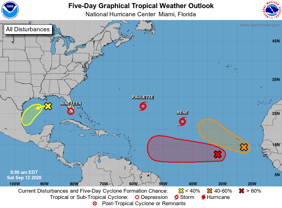
While Rene is spinning about in the open waters of the Atlantic, the National Hurricane Center is monitoring three additional areas of potential tropical cyclone development.

The most impressive of the bunch is a disturbance moving into the central Atlantic. The National Hurricane Center believes there’s an 80% chance that this will become a tropical cyclone in the next 48 hours or 90% chance over the next 5 days. This system could grow into the next named system of the year, which would be Teddy.
Another system in the eastern Atlantic is also showing promise of development. The National Hurricane Center says there are now medium odds that a tropical cyclone will form there within the next five days.
The National Hurricane Center is also monitoring an area of disturbed weather in the Gulf of Mexico ahead of the system moving across Florida now. A surface trough over the north-central Gulf of Mexico is producing disorganized showers and a few thunderstorms. According to the National Hurricane Center, some slow development of this system is possible while it moves westward and then southwestward over the northern and western Gulf of Mexico through the middle of next week. However, odds of tropical cyclone formation are low for now; the National Hurricane Center says there’s only a 20% chance of formation over the next 48 hours and only a 30% chance over the next five days.