Source: National Oceanic and Atmospheric Administration (NOAA), Oceanic and Atmospheric Research (OAR), Climate Program Office (CPO), Climate.gov; NOAA National Centers for Environmental Information (NCEI)
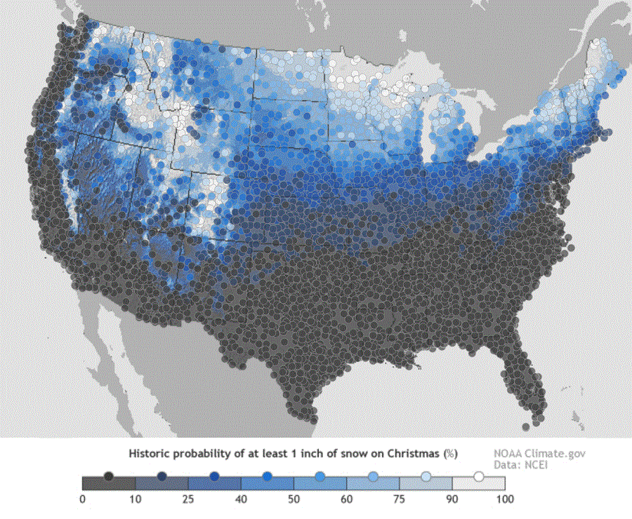
While some may be dreaming for a white Christmas, many are wondering if their dreams will turn into forecast reality. The map here shows the historic probability of there being at least 1 inch of snow on the ground in the Lower 48 states on December 25 based on the latest (1981-2010) US Climate Normals from NOAA’s National Centers for Environmental Information (NCEI).
The 1981–2010 Climate Normals are the latest three-decade averages of several climatological measurements. This collection contains daily and monthly normals of temperature, precipitation, snowfall, heating and cooling degree days, frost/freeze dates, and growing-degree days calculated from observations at approximately 9,800 stations operated by NOAA’s National Weather Service (NWS).
While the map shows the historical probability that a snow depth of at least one inch will be observed on December 25, the actual conditions in any year likely vary from the norm. Different weather patterns and storm systems each December set the stage for whether or not there will be snow on the ground for Christmas Day.
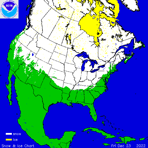
This year, the area of snow cover is greater than normal, especially over the upper Mississippi and Ohio River Valleys. According to NOAA’s most recent analysis, a large chunk of the northern United States has some snow cover today, stretching across much of Washington, Oregon away from the coast, the highest terrain of California, Nevada, much of northern Utah, most of Colorado, most of Kansas, the northeastern half of Oklahoma, northern Arkansas, western Tennessee, the mountains of western North Carolina and Virginia, West Virginia, Pennsylvania, New York, and much of northern New England away from the coast –as well as points all north of here.
As expected, the coastal plain of the Mid Atlantic and southeastern New England is free of snow cover, disappointing those who were dreaming of a White Christmas there.
