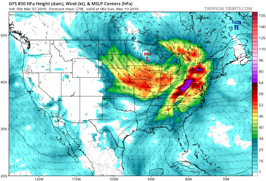
A strong low pressure system moving through the Great Lakes this weekend is likely to produce another significant wind event for many. Image: tropicaltidbits.com
Beyond the wind, some soaking rains will impact portions of the east too as this weather system moves through. On Saturday night and into Sunday, a strong low pressure system will be moving across the Great Lakes Region. This low will lift a warm front toward the Mid Atlantic overnight Saturday before sweeping a cold front across the region during the day Sunday. Lift will increase across the northeast as several short wave / vorticity impulses slide across the area north of the warm front and in association with the cold front. This lift, combined with increasing moisture will lead to an extended period of rain chances overnight Saturday into Sunday afternoon in an area that has seen plenty of rain this winter. Depending on how early the precipitation starts, there will likely be some freezing and/or frozen precipitation overnight Saturday into Sunday morning for portions of eastern Pennsylvania, and northern and central New Jersey before it all changes to rain. North of there, mainly snow is expected while south of there, plain rain is forecast. There is also the potential for moderate to locally heavy rainfall in the area seeing rain, which could lead to some flooding concerns.
