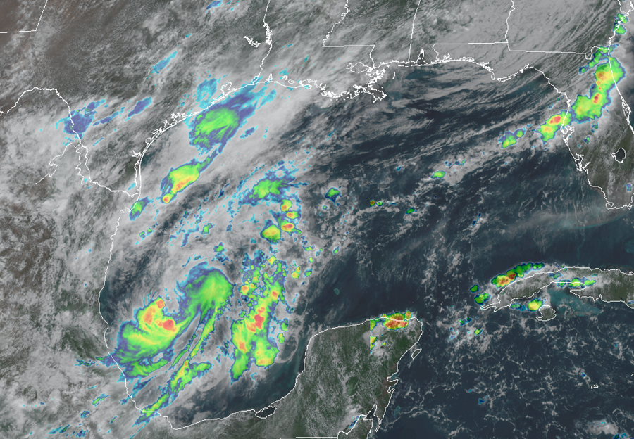
The last name on the list of names that the National Hurricane Center in Miami, Florida will use this year looks like it’ll be used soon in the Gulf of Mexico: Wilfred. A tropical disturbance is getting better organized in the Gulf of Mexico and the National Hurricane Center says there is now a 90% chance that it’ll become a tropical cyclone within the next 48 hours.
Shower and thunderstorm activity has changed little today in association with an area low pressure system located over the southwestern Gulf of Mexico. However, according to the National Hurricane Center, upper-level winds are gradually becoming more conducive for development, and a tropical depression or a tropical storm could form within the next day or so.
An Air Force Reserve reconnaissance aircraft is scheduled to investigate the disturbance this afternoon.
The National Hurricane Center says the low is expected to meander over the southwestern Gulf of Mexico through tonight before moving slowly northward to northeastward on Friday and Saturday. From there, the system could turn to the north or northwest, bringing it closer to the Texas or Louisiana coast. Both states have been hit by tropical cyclones already this year.
If it forms into a tropical storm, this disturbance would be the 21st named storm of the Atlantic hurricane season. Only a few seasons have had that many storms; for those that did, none had the 21st storm form so early in the season. The current record for earliest 21st named storm in the Atlantic basin was Vince which formed on October 8, 2005. Once Wilfred is used, the National Hurricane Center would label future named storms after letters of the Greek alphabet. The first letter up would be “Alpha”; it was only used three times before; twice for subtropical storms and once for a tropical storm.
The 2020 Atlantic Hurricane Season runs through to the end of November.