A wild weather pattern is setting the stage for two more blizzards in the northeast after another potent low pressure system whipped portions of southeastern New England and Long Island with blizzard conditions.
A system later tonight into tomorrow will slide down from the Canadian side of the Great Lakes into the northeast, triggering light snow shower activity across upstate New York. Some light snow may reach south into northeastern Pennsylvania, the northern third of New Jersey, and even the metro area of New York City including Long Island. While a dusting of snow to an inch is possible on the southern side of this system, 1-3″ is possible further north into New England.
A more robust low pressure system will enter the Mid Atlantic late Saturday into Sunday, bringing rain showers to places like Pennsylvania, New Jersey, and New York. As this system makes it way to the Maine coast on Monday, cold air will wrap around the system as it rapidly intensifies south of Nova Scotia. As it does so, heavy snow will break out in Maine from this system. Snow will be thrown back to central Massachusetts and points north, where several inches of fresh snow is expected to fall. In Maine, though, 12-18″ is possible, with the most expected in eastern coastal Maine and much less in the northernmost part of the state.
With powerful winds from this rapidly intensifying system, blizzard conditions will form in eastern Maine, with strong, potentially damaging wind gusts and near-zero visibility due to heavy falling and blowing snow.
This robust system will be far enough away from New York City and places south, like New Jersey, Pennsylvania, Delaware, and Maryland, to bring any precipitation there.
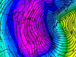
After this blizzard exits the northeast on Monday, eyes will turn to yet another potential storm. Some computer forecast guidance that meteorologists use to aid in their forecasting show another strong low pressure system along the northeastern coast during the middle of the week. As with the last two systems, this next system could go through explosive strengthening, setting the stage for blizzard conditions somewhere in the northeast again.
Next week’s mid-week storm could bring another round of heavy snow whipped up by powerful winds. The best chance of snow will be in areas that saw snow from yesterday’s storm and will see snow from Monday’s storm; odds for snow are low at this time for places south of New York City and northeastern Pennsylvania, although that could change as the stormy weather pattern evolves over the next few days.
