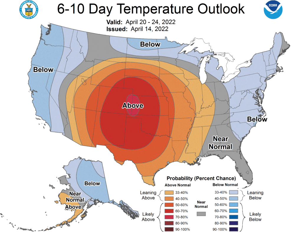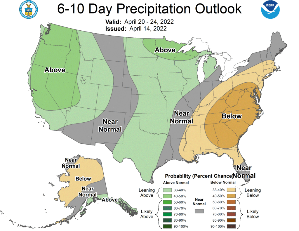
The National Weather Service’s Climate Prediction Center has released their latest 6-10 day outlook for temperatures and precipitation across the continental United States and Alaska. It shows evolving conditions with warm weather anchored over the middle of the country rather than the east, with more wet conditions head west than east.

According to the CPC’s 6-10 Day Temperature Outlook, the weather pattern favors a broad area of above average temperatures, centered over the central Great Plains, extending westward over the Great Basin, northward over South Dakota, as far east as the lower Ohio River valley and south to the U.S.-Mexico border. The analysis also suggests that there is a slight chance of below average temperatures along the U.S. West Coast and parts of the U.S.-Canada border, as well as the central and northern Eastern Seaboard. Below average temperatures are also favored for most of Alaska, with the exception of the western coastal areas and the Aleutian Islands, which are expected to be above normal.

The latest guidance from the CPC also shows that above average precipitation is expected for the Pacific Northwest, extending southward to include California and eastward to include the Great Basin and the northern Rockies. There is also an area of above-average precipitation extending from the Texas-Mexico border northward across the Great Plains and into the upper Midwest, with the highest probabilities for northern Minnesota, Wisconsin and the Upper Peninsula of Michigan. Below-average precipitation is expected for the lower Mississippi and Ohio River valleys and eastward to the Atlantic coast and southern New England, with the highest probabilities of below-normal precipitation centered over the Mid-Atlantic and Appalachian regions. For Alaska, below average precipitation is expected for central and northern portions of the state, while above-normal precipitation is more likely for the Alaskan panhandle.