More than 6″ of snow fell from New Jersey to Maine since last night, with lingering snow showers due to wrap up over much of New England by tonight and eastern Maine by tomorrow morning. While people dig out of this snowstorm, eyes are on the next one. For now, it looks like the weekend system will be milder than this most recent one, which will keep southern New England and the northern Mid Atlantic more wet than white.
Here are some snowfall reports received and reported by the National Weather Service through this afternoon:
Maine
Roque Bluffs: 9″
Machiasport: 5.5″
Whiting: 4.5″
Jonesboro 4″
Connecticut
Burlington: 7″
North Canton: 7″
Danbury: 7″
New Canaan: 7″
North Granby 6.7″
West Hartford: 6″
Massachusetts
Plainfield: 8″
Chesterfield: 7.5″
Amherst: 4″
Falmouth 4″
Rhode Island
West Greenwich: 8.3″
Foster: 7″
West Warwick: 6.7″
Jamestown: 4″
New York
Port Jervis: 8.5″
Chester: 7.5″
Peru: 7.4″
White Plains: 6″
Bronx: 5.6″
LGA Airport: 2.7″
Central Park: 1.8″
JFK Airport: 1.5″
Staten Island: 0.6″
New Hampshire
Portsmouth Airport: 4″
Plymouth: 3.6″
Madison 3.5″
Concord: 2.1″
New Jersey
Vernon: 6.9″
Highland Lakes: 6.9″
Wantage: 6.4″
Green Pond: 6.1″
Sussex: 6″
Kinnelon: 6″
Allendale: 6″
Oakland: 6″
Montclair: 5″
Westwood: 4.5″
New Brunswick: 1.2″
Woodbridge: 1″
Trenton: 1″
West Windsor: 1″
South River: 0.8″
Freehold: 0.6″
Hamilton Square: 0.6″
Vermont
Hardwick: 9.1″
Groton: 8″
Hancock: 7.5″
St. Johnsbury: 6″
Pennsylvania
Mount Pocono: 7.5″
Pocono Pines: 6.6″
Jackson: 5.4″
Bangor: 5″
Summit Hill: 4.4″
Bushkill: 4″
Allentown: 2.2″
Willow Grove: 1″
Reading: 0.3″
Chadds Ford: 0.1″
Bryn Mawr: 0.1″
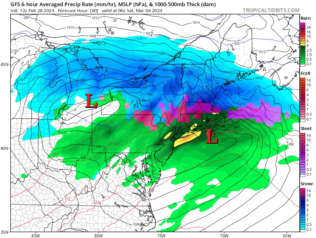
With this storm wrapping up, eyes are on the next one. According to the National Weather Service, there continues to be good agreement among model guidance that a strong storm system will develop across the Mississippi Valley and track through the Ohio Valley towards the Great Lakes and northern New England. A potent upper trough will eject out of the southwest U.S. overnight Thursday into Friday and rapidly obtain a negative
tilt as it progresses into the Ohio Valley. The attendant surface low now will probably follow a similar track to yesterday’s storm, potentially redeveloping somewhere across the coast or just offshore. But without a lock of cold air in place before the storm arrives, the precipitation will be liquid across a larger part of the southern side of this storm.
Right now, it appears the rain/snow line will set up near the Pennsylvania/New York, New York / New Jersey, and Connecticut/Massachusetts’s borders with rain to the south, snow well to the north, and an icy mix of freezing rain and/or sleet setting-up in the middle. While it is too soon to say with a high degree of confidence what snowfall amounts will be, they appear to be less than what just fell due to the lack of dense, cold air.
