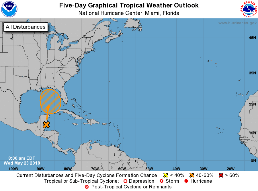
The National Hurricane Center increased odds slightly again that a disturbance near Belize today will blossom into a tropical or subtropical cyclone over the next 5 days; the chance of that formation is now at 60%.
The National Hurricane Center provided an update on their forecast of this system this morning.A broad surface low centered near the coast of northeastern Belize continues to produce a large area of cloudiness and showers extending from the northwestern Caribbean Sea across Cuba and into the Florida Straits. According to the National Hurricane Center, little development is expected during the next couple of days due to strong upper-level winds and proximity to the Yucatan Peninsula. However, environmental conditions are then forecast to become more conducive for development, and a subtropical or tropical depression could form this weekend over the eastern or central Gulf of Mexico.
The American GFS, European ECMWF, and Canadian GEM forecast models are all suggesting some type of development with this system over time, although they all have radically different solutions with where the system goes and how strong it gets. With a weak steering environment and a mediocre environment for additional development, meteorologists don’t have much confidence in how this system will evolve over the next week.
Regardless of development, locally heavy rainfall is possible across western Cuba, the Cayman Islands, and much of Florida during the next several days. Depending on how the system develops and where it goes, that heavy rain threat could head deeper into the southeastern US or the Gulf Coast; there’s also a threat heavy rain as far north as the Mid Atlantic could fall, although that will be dependent on a variety of factors not yet completely known at this time.
