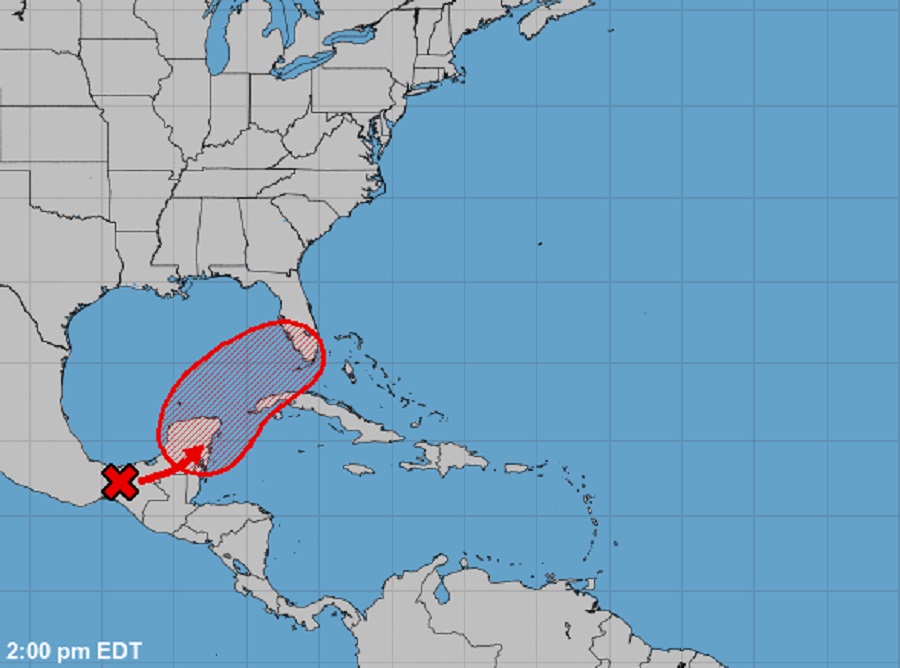
In the latest Tropical Outlook issued a short time ago by the National Hurricane Center in Miami, Florida, meteorologists there now believe there is a 70% chance that what’s left of Hurricane Agatha over Mexico will redevelop as it moves over the Gulf of Mexico. As a result, the threat of direct or indirect impacts to Florida and the U.S. East Coast continue to increase from this likely tropical cyclone.
According to the National Hurricane Center (NHC), in an area near the Yucatan Peninsula and the Southeastern Gulf of Mexico, a large and complex area of low pressure is expected to develop in a couple of days, partially related to the remnants of Hurricane Agatha from the eastern Pacific. Despite strong upper-level winds over the area, this system is likely to become a tropical depression while it moves northeastward over the northwestern Caribbean Sea and southeastern Gulf of Mexico late Thursday or Friday.
Regardless of development, locally heavy rainfall is likely across portions of southeastern Mexico, the Yucatan Peninsula, Guatemala, and Belize during the next couple of days, spreading across western Cuba, southern Florida, and the Florida Keys on Friday and Saturday.

While it is too early to say with certainty where this system will go and/or how strong it’ll get, the NHC cautions that interests in the Yucatan Peninsula, western Cuba, the Florida Keys, and the Florida Peninsula monitor the progress of this system.
The 2022 Atlantic Hurricane Season officially kicks off tomorrow, June 1. The season stretches through to the end of November. The first named system in the Atlantic Basin will be named “Alex.”
Because Hurricane Agatha dissipated over Mexico, any redevelopment of its remnants would be given a new name as it re-enters the Atlantic basin. If these remnants become organized into a tropical storm, it would earn the name Alex. Outside of this system, the NHC doesn’t believe any tropical cyclone will form anywhere in the basin over the next five days.