A major computer forecast model is suggesting that the first week of the 2026 Atlantic Hurricane Season could feature a tropical cyclone and such a cyclone could become a tropical storm threat for Florida.
The GFS and ECMWF are among many computer models meteorologists use to assist in weather forecasting. While meteorologists have many tools at their disposal to create weather forecasts, two primary global forecast models they do use are the ECMWF from Europe and the GFS from the United States. While the models share a lot of the same initial data, they differ with how they digest that data and compute possible outcomes. One is better than the other in some scenarios, while the opposite is true in others. No model is “right” all the time. Beyond the ECMWF and GFS models, there are numerous other models from other countries, other academic institutions, and private industry that are also considered when making a forecast.
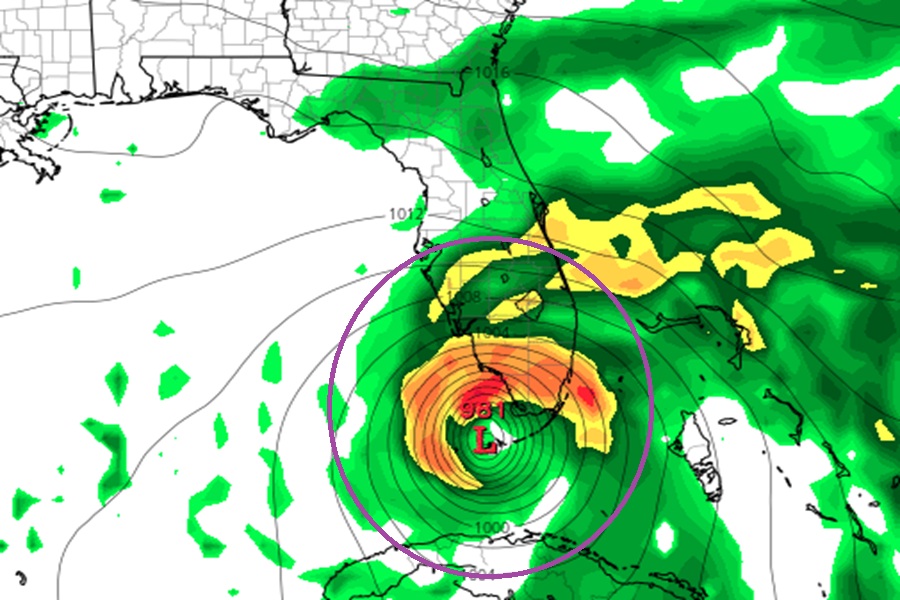
Today, the American GFS computer model is suggesting that a tropical cyclone could take shape next week in time for the start of the new hurricane season which begins on June 1. For the upcoming weekend, it should a disturbance east of the Yucatan Peninsula slowly becoming better organized. From there, it tracks the system over western Cuba into southern Florida around June 4. From there, it shows the system slowly moving up Florida’s peninsula into the panhandle region before it spins about and heads northwest towards Alabama and Mississippi around June 9.
Among global computer forecast guidance, though, the GFS is alone on such a tropical cyclone projection. Other guidance, including the European ECMWF, does not predict any tropical cyclone taking shape near Florida over the next 10 days.
The National Hurricane Center (NHC) does not believe at this time that a tropical cyclone will take shape in the first days of the upcoming hurricane statement. In today’s brief Tropical Outlook, the NHC said, “For the North Atlantic, Caribbean Sea and the Gulf of America, tropical cyclone formation is not expected during the next 7 days.”
Experts believe the upcoming season may be less active than usual. Last week, NOAA released a forecast showing 55% odds of a below-normal season. In April, experts with CSU released their own outlook which also calls for a less active season.
