The National Hurricane Center (NHC) in Miami, Florida is monitoring two systems within the Atlantic Hurricane Basin for possible tropical cyclone development in the coming days. While neither pose an immediate threat in the short-term, one of the disturbances has the potential to grow into a robust system with time.
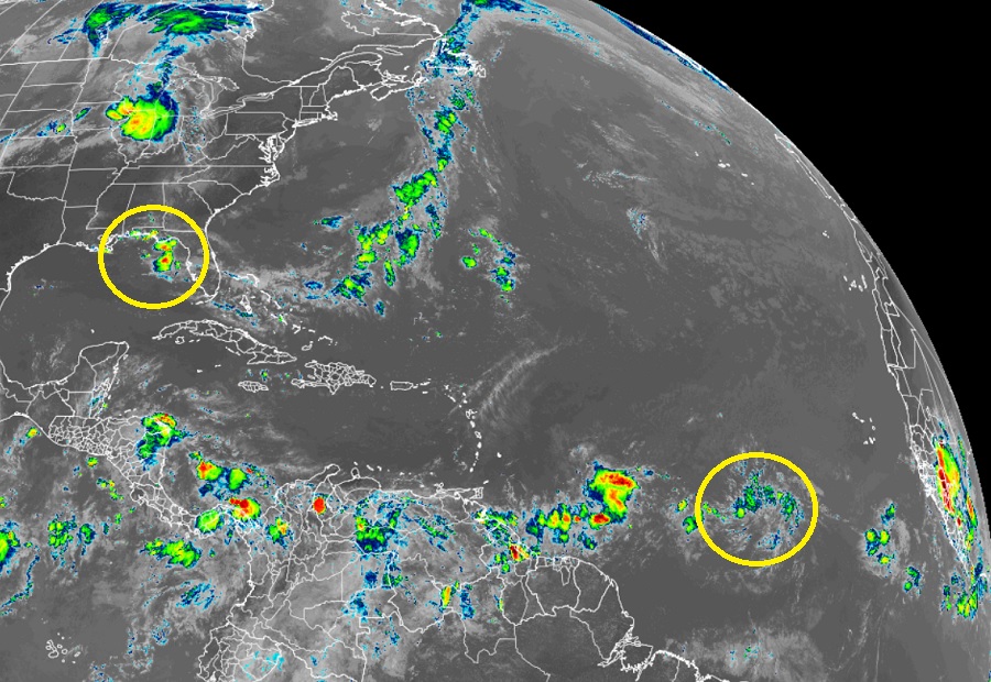
The area of concern closest to the United States is in the northern Gulf of Mexico. Here, an area of clouds, showers, and thunderstorms extend from the southeastern United States across the Florida Peninsula to near the northwestern Bahamas. This area of disturbed weather is associated with a trough of low pressure in the region. The NHC says that slow development of this system could occur as it drifts west across the northern Gulf of Mexico in the coming days. However, odds of development are low. The NHC believes there is a zero chance of development over the next 48 hours and only a 20% chance over the next five days.
A system that could be more promising over time is over the central Atlantic. A tropical wave half way between the Windward Islands of the Caribbean and the coast of Africa could develop over the next several days as it drifts west over the open waters of the warm tropical Atlantic. The NHC says environmental conditions appear conducive for development over the next few days and a tropical depression could form during the early to middle part of next week. While the NHC hasn’t publicly discussed what could happen next with this system, several global computer forecast models suggest the storm could become a hurricane in about 5 days. It is still too soon to say with a great deal of confidence where this system will go and how strong it’ll be when it gets there. For now, the NHC has this system forecast to move west at 15-20 mph over the tropical Atlantic, approach the Windward Islands on Tuesday, and move across the Caribbean Sea on Wednesday and Thursday. While the NHC says there’s only a 30% chance that a tropical cyclone will form here over the next 48 hours, they do boost those odds to 60% over the next 5 days.

Elsewhere in the Atlantic Hurricane Basin, the NHC expects no tropical cyclone development over the next 5 days.
The 2022 Atlantic Hurricane Season began on June 1 and continues through to the end of November.
