• Skip to primary navigation
  • Skip to main content
  • Skip to primary sidebar

Weatherboy

Weatherboy Weather News, Maps, RADAR, Satellite, and Forecasts.

  • Local
  • Earth Science News
  • RADAR
  • Current Warnings
  • Satellite
  • Current Maps
  • Forecast Maps
  • Video

Hurricane Dora Picks Up Strength; Indirect Impacts to Hawaii Likely

by Weatherboy Team Meteorologist - August 2, 2023

This colorized satellite photograph of circled Hurricane Dora shows warmer sea surface temperatures in oranges and reds and colder sea surface temperatures in blues and greens. Image: NOAA


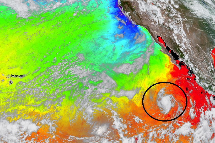
Hurricane Dora has intensified to a category 2 hurricane on the Saffir-Simpson scale and additional strengthening is expected, according to the National Hurricane Center (NHC). The NHC believes the hurricane or its remnants will track well south of Hawaii, but indirect impacts in the form of rough seas and wave action are expected around Hawaii in the coming days.

As of the latest update from the NHC, Dora had maximum sustained winds of 110 mph as it moved west at 16 mph across the open eastern Pacific. Minimum central pressure is estimated at 974 mb or 28.77″. While it’s packing a punch, Dora is a tiny storm; hurricane force winds only extend out about 15 miles from the center while tropical storm force winds extend out to 45 miles.  The storm is 2,610 miles east-southeast of Hilo, Hawaii.

The official forecast track from the National Hurricane Center keeps Dora away from Hawaii at this time. Image: NHC


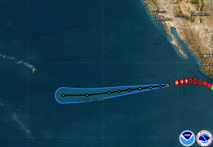
The NHC expects Dora to continue its westward to west-southwestward motion for the next several days. While it heads closer to Hawaii, it is also expected to change strength.  While maximum sustained winds have increased to near 110 mph with higher gusts now, the NHC says that Dora is forecast to become a major hurricane overnight tonight. Afterwards, a gradual weakening is forecast to begin by Friday.


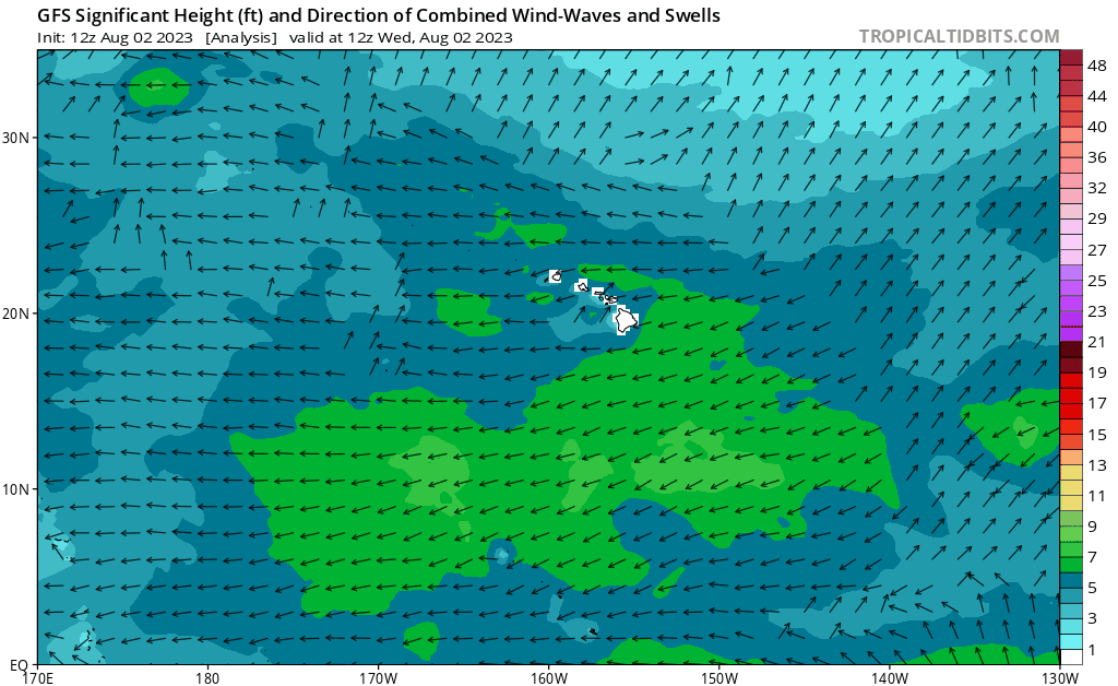
While Dora is expected to pass well south of Hawaii, it is expected to whip up significant waves and swells that will lash Hawaii during the early to middle part of next week, with the Big Island of Hawaii seeing most of the wave action. While much of the swell should remain south of Hawaii, some swell should impact all of the islands in the state.

Simulated wave data from the American GFS computer forecast model shows that while the center of Dora should head well south of Hawaii, large waves and rough surf should lash the islands anyway. Image: tropicaltidbits.com


Primary Sidebar

Sponsored Ad

Search

Latest News

  • Weak Morning Earthquake Rattles Maine
  • Nor’Easter Keeping Weather Cool and Damp in Northeast This Week
  • Miami’s National Hurricane Center Monitors Area for Cyclone Development
  • Scientists Unlock Climate Change Secrets: Say Ice Age Is Coming
  • Tornado Confirmed in New Jersey
  • National Hurricane Center Initiates Daily Reports Today
  • Severe Weather Likely Across Broad Area on Friday
  • Heat Blast Expected from Texas to Florida and from Minnesota to Arkansas
About | Careers | Contact | Contests
Terms | Privacy | Ad Choices
Weatherboy is a (R) Registered Trademark of isarithm LLC, All Rights Reserved.
All content herein is Copyright by Isarithm LLC 1997-2022