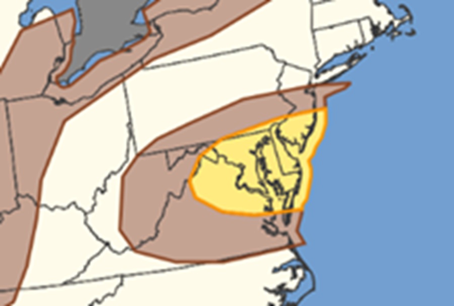
Severe thunderstorms with a damaging wind threat are expected to return to portions of the Mid Atlantic today, with the greatest threat of wind damage over southern New Jersey, all of Delaware, much of Maryland, northern Virginia, and parts of southern Pennsylvania. Washington DC is included in this wind threat zone.
According to the National Weather Service’s Storm Prediction Center (SPC), a moist airmass will remain in place across the Mid-Atlantic today, characterized by afternoon dewpoints in the upper 60s to mid 70s. Airmass destabilization is expected by the early afternoon, with moderate to strong buoyancy likely. A low-amplitude shortwave trough currently over Tennessee/Kentucky is forecast by the SPC to progress northeastward, interacting with the moist and unstable airmass to support thunderstorms. While the thermodynamic characteristics of the airmass remain similar to the last few days, increased large-scale ascent and slightly stronger mid-level flow attendant to the shortwave will likely support greater storm coverage and intensity.
Moderate vertical shear will support a predominantly outflow-dominant multicellular mode, with damaging wind gusts as the primary risk, particularly in areas where few clouds allow for more heating and steeper low-level lapse rates. While severe thunderstorms may drop damaging hail or create an isolated tornado or two, the predominant threat will be from severe winds today.
There is also a risk of damaging winds near the Lower Great Lakes into portions of New England. Moderate westerly/southwesterly flow aloft at the base of a shortwave trough moving across Ontario and Quebec will extend from the Lower Great Lakes region through New England this afternoon. The SPC says a modest cold front associated with the shortwave will shift eastward/southeastward into the region as well, interacting with the warm, moist and unstable airmass in place to support scattered thunderstorms this afternoon. Poor mid level lapse rates will keep buoyancy modest, but the moderate westerly/southwesterly flow aloft could still support some stronger bowing segments capable of damaging gusts there.
