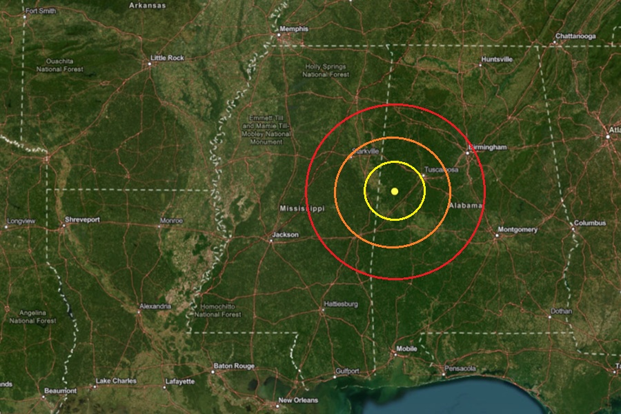
A weak earthquake rattled west central Alabama this weekend. According to USGS, a magnitude 2.4 earthquake struck at 2:37 pm Saturday afternoon near the town of Union, Alabama, which is southwest of Tuscaloosa. USGS reports there has been no other seismic activity within 250 km of this earthquake over the last three weeks.
Earthquakes with a magnitude of 2.0 or less are rarely felt or heard by people, according to USGS, but once they exceed 2.0 more and more people can feel them. While damage is possible with magnitude 3.0 events or greater, significant damage and casualties usually don’t occur until the magnitude of a seismic event rises to a 5.5 or greater rated event.
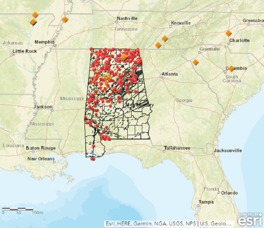
According to the Geological Survey of Alabama (GSA), earthquakes aren’t completely rare in the state. According to GSA, “Most of the earthquakes we experience in Alabama are associated with the Southern Appalachian Seismic Zone (an extension of the East Tennessee Seismic Zone) that runs along the Appalachian Mountains from the northeastern corner into the central part of the state and the Bahamas Fracture Seismic Zone in southern Alabama.
The strongest earthquake to ever hit the state was a magnitude 5.1 event in 1916 in northern Shelby County.
The second and third strongest earthquakes were each rated as a magnitude 4.9 event. One struck in DeKalb County, 10 miles northeast of Fort Payne, on April 29, 2003. The earthquake was widely felt across the northern half of Alabama and Georgia, much of Tennessee, and even portions of Kentucky, North and South Carolina, and Mississippi. The other struck in Escambia County on October 24, 1997; that earthquake was responsible for a berm around a lake to fail, spilling water and fish across a road. Large cracks also developed in sand along a creek not far from the epicenter. Both 4.9 magnitude events did some damage, mainly to weaker masonry found in the northern part of the state.
