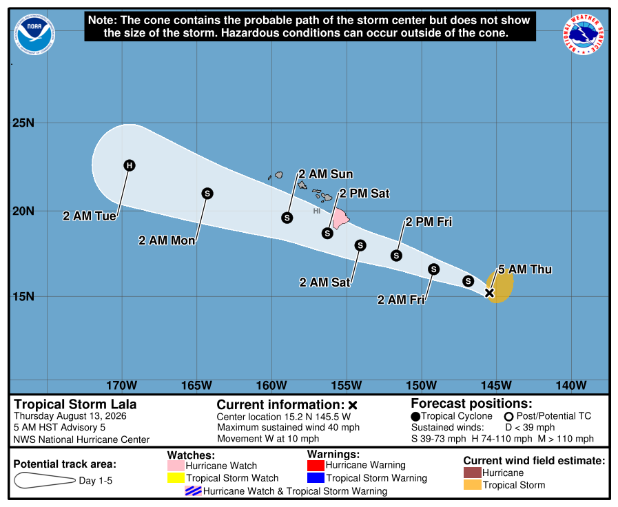
Tropical Storm Lala is picking up strength and is now forecast to become a hurricane before it strikes the southern part of the Big Island of Hawaii, prompting the Central Pacific Hurricane Center to upgrade the Hurricane Watch that was issued earlier today to a Hurricane Warning. In addition, Tropical Storm Watches are now up for Maui and Oahu. Maui County includes the islands of Lanai, Molokai and Kahoolawe too.
A Hurricane Warning means that hurricane conditions are expected somewhere within the warning area. A warning is typically issued 36 hours before the anticipated first occurrence of tropical-storm-force winds, conditions that make outside preparations difficult or dangerous. Preparations to protect life and property should be rushed to completion.
A Tropical Storm Watch means that tropical storm conditions are possible within the watch area, in this case within the next 36 to 48 hours.
“Interests elsewhere in the main Hawaiian Islands, and in the Papahanaumokuakea Marine National Monument, should monitor the progress of this system,” warns the Central Pacific Hurricane Center.
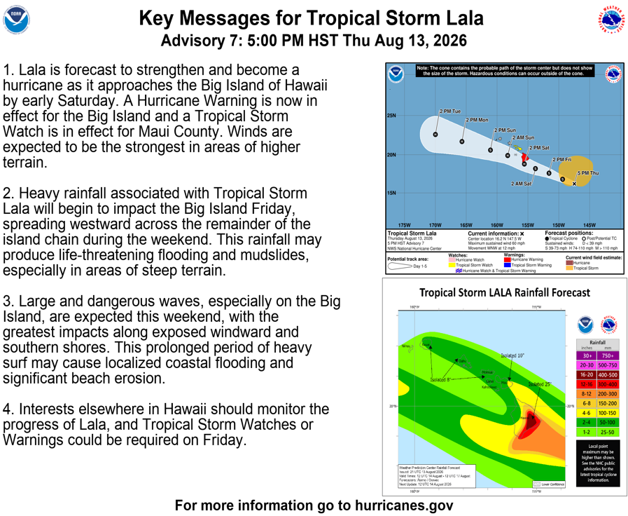
As of 5 pm Hawaii time, the center of Tropical Storm Lala was at 16.2 N 147.5 W which is roughly 555 miles east-southeast of Hilo, Hawaii and about 765 miles east-southeast of Honolulu, Hawaii. Maximum sustained winds are up to 60 mph. Minimum central pressure is down to 997 mb or 29.44″. The storm is moving west-northwest at 12 mph.
Hurricane conditions are expected on the Big Island of Hawaii by early Saturday, with tropical storm conditions possible in Maui County by late Saturday. Wind speeds atop and on the windward sides of slopes and mountains are often up to 30 percent stronger than the near-surface winds indicated in this advisory, and in some elevated locations could be even greater.
Tropical Storm Lala is expected to produce rainfall totals of 8 -12″ across Maui and the Big Island with maximum totals of 25″ inches possible across the Big Island. Rainfall totals of 4-6″ with maximum amounts of 8″ are expected across the remainder of the island chain. This rainfall may produce life-threatening flooding and mudslides, especially in areas of steep terrain.
The combination of a dangerous storm surge and the tide will cause normally dry areas near the coast to be flooded by
rising waters moving inland from the shoreline. The water could reach 1-3′ above ground along the Big Island coastline if the peak surge occurs at the time of high tide. The deepest water will occur along the immediate coast, where the surge will be accompanied by large and dangerous waves. Surge-related flooding depends on the relative timing of the surge and the tidal cycle, and can vary greatly over short distances.
Swells generated by Lala are expected to reach the east-facing shores of the state on Friday, spreading westward and building through the weekend. These swells are likely to cause life-threatening surf and rip current conditions.
The hurricane may also spin-up tornadoes on the Big Island and waterspouts in the off-shore waters.
Before the hurricane arrives, there’s also threat of fire. Fire weather concerns will increase on Friday ahead of any potential tropical cyclone`s arrival. Winds will begin to strengthen while a dry and stable air mass with low relative humidity moves overhead. This combination of lower relative humidity and increasing wind speeds will approach critical fire weather criteria. Strong winds can lead to extreme fire behavior even if relative humidity values are not quite low enough to officially make criteria. Increasing humidity and rainfall with Lala will remove fire weather concerns from Saturday into at least early next week.
