
Winds strong enough to topple trees and power lines are forecast to sweep north-central Montana on Sunday, with gusts up to 95 mph and isolated gusts around 100 mph along the Rocky Mountain Front, the National Weather Service said.
The weather service office in Great Falls said in a 3:25 a.m. MST update that a high wind warning remains in effect until 8 p.m. for the East Glacier Park Region, the Northern High Plains, the Southern High Plains and an area covering eastern Glacier, western Toole and central Pondera counties. West winds of 35 to 55 mph are expected there, the warning said.
The warned area includes Browning, Cut Bank, East Glacier Park, Saint Mary, Babb, Heart Butte, Choteau, Bynum, Dupuyer, Pendroy, Marias Pass and Logan Pass.
“Damaging winds will blow down trees and power lines. Widespread power outages are expected. Travel will be difficult, especially for high profile vehicles,” the warning said.
A Stronger Forecast Overnight
The forecast for the Front grew more severe over the past day. At 11 a.m. MST Saturday, the Great Falls office forecast gusts up to 85 mph, with isolated gusts up to 90 mph along the immediate eastern slopes of the northern Rockies.
By early Sunday, forecasters raised that to gusts up to 95 mph and isolated gusts around 100 mph. In its forecast discussion, the office said sounding and cross-section analysis showed stronger upper-level winds and favorable conditions for mountain wave development along the Front.
That analysis and computer model guidance supported “upper level winds as strong as 100 MPH mixing down to the surface by late Sunday morning across the Front,” forecaster Dzomba wrote.
The weather service also widened its warnings. At 10:21 p.m. MST Saturday, the office upgraded high wind watches to warnings for eastern Toole and Liberty counties, Hill County, Cascade County below 5,000 feet, and Judith Basin County and Judith Gap. It extended the warnings to northern Blaine County, eastern Pondera and eastern Teton counties, western and central Chouteau County, and the Bears Paw Mountains and southern Blaine County.
Those areas are under a high wind warning from 8 a.m. to 8 p.m. MST Sunday. West winds of 30 to 40 mph with gusts up to 65 mph are expected there, the weather service said. The warning lists Great Falls, Havre, Shelby, Conrad, Fort Benton, Chester, Chinook, Harlem, Stanford, Geyser, Rocky Boy and Fort Belknap among the communities included.
The same impacts language applies: downed trees and power lines, widespread outages and difficult travel for high-profile vehicles. The weather service urged people to secure loose objects that could be blown around or damaged.
Why the Front Gets So Windy
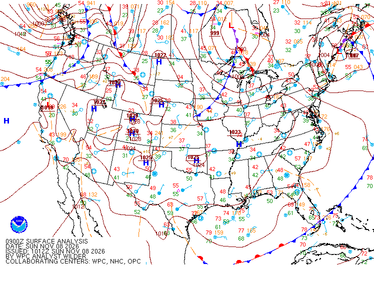
The weather service said a ridge of high pressure aloft is breaking down Sunday morning, tightening the pressure gradient over Montana. A tighter pressure gradient, or a sharper change in pressure over a short distance, drives stronger wind.
The strongest winds are forecast along the eastern slopes of the Rocky Mountain Front, where the office said “favorable thermal conditions exist for mountain wave development.” When strong winds blow across a mountain range under the right conditions, the air can ripple downstream in waves, much like water flowing over a rock in a stream, and drive fast winds from higher up down toward the ground.
Daytime heating will help that process, the office said. “This, combined with diurnal heating, will allow the stronger winds aloft to mix down to the surface, creating the possibility of isolated 100 MPH gusts along the Front,” the discussion said.
Elsewhere in north-central Montana, winds about 5,000 to 10,000 feet above sea level average around 65 mph, with winds near 10,000 feet peaking around 70 mph, the office said. Models show strong winds spreading across the Hi-Line, with pockets of stronger winds possible along U.S. Highway 87, forecasters said.
The office’s aviation forecast warned of low-level wind shear early Sunday at the Cut Bank and Havre airports, with winds of 50 to 60 knots at and above 1,500 feet above ground. It also warned of mountain wave turbulence over the Front and up to 50 nautical miles downwind.
Television station KTVH in Helena reported Friday that a storm track sending a series of low pressure systems across southern Canada, north of Montana, typically “creates significant wind across the mountains and plains of Big Sky Country.”
Early Observations and Saturday’s Winds
The strongest winds had not yet arrived in the early morning hours Sunday. Observations at Great Falls International Airport showed gusts near 30 mph shortly after 4 a.m. MST, and winds at Cut Bank were lighter.
The region already had a taste of the pattern Saturday. A mesonet station east of Fort Benton in Chouteau County recorded a 62 mph gust at 3:15 a.m. MST Saturday, according to a weather service local storm report. A Montana Department of Transportation station near Geyser in Judith Basin County recorded a 58 mph gust at 4:30 a.m. and averaged 44 mph sustained winds over the hour ending at 5 a.m., the weather service said.
As of early Sunday, the weather service had not issued any storm reports for Sunday’s winds, and no confirmed reports of outages, road closures or damage tied to Sunday’s wind had been published. Travelers can check road conditions through the Montana Department of Transportation’s traveler information system, and NorthWestern Energy posts outages on its online map.
Warm, Windy and Near Records
The wind comes with unseasonable warmth. The Great Falls office forecast a high of 65 degrees in Havre on Sunday, two degrees shy of the record of 67 for the date, and 62 in Helena, close to the record of 64.
Forecast highs Sunday are 63 in Great Falls and 55 in Cut Bank, the office said.
Television station KRTV in Great Falls reported Saturday that highs were 10 to 15 degrees above average across much of Montana and Wyoming, ahead of a trough of low pressure and cold front moving over the northern Rockies on Sunday and early Monday.
What Comes Next
The weather service said winds will have “greatly dissipated” by Sunday evening as the ridge moves east and the flow aloft turns more west to east. Monday and Tuesday will be slightly cooler but still near seasonal averages, the office said.
Light precipitation is possible over the higher elevations of the northern Rockies Sunday evening into Monday morning. Snow levels will drop to around 4,000 feet north of Lincoln, with the potential for a light dusting of snow over Marias Pass, the office said.
The break will be short. Forecasters said a disturbance moving through southwestern Montana will tighten the pressure gradient again Tuesday, producing another windy day across central and north-central Montana, with the strongest winds again along the Rocky Mountain Front.
A strong ridge of high pressure is then forecast to build in by Wednesday, bringing warm temperatures and little to no chance of precipitation through the rest of the week. The office forecast a high of 66 in Great Falls on Wednesday, Nov. 11, close to the record of 69.
