The National Weather Service in Los Angeles/Oxnard issued a Red Flag Warning on Thursday for wind-prone mountain and valley corridors spanning Los Angeles and Ventura counties, citing a weekend return of Santa Ana winds, critically dry fuels and humidity low enough to support rapid fire growth if new starts occur.
The warning takes effect from 2 a.m. to 6 p.m. PST Saturday for the Santa Clarita Valley, the western and eastern Santa Monica Mountains recreational areas, the Santa Susana Mountains and the western San Gabriel Mountains along the Highway 14 corridor, according to the weather service fire weather message issued at 1:36 p.m. PST Thursday.
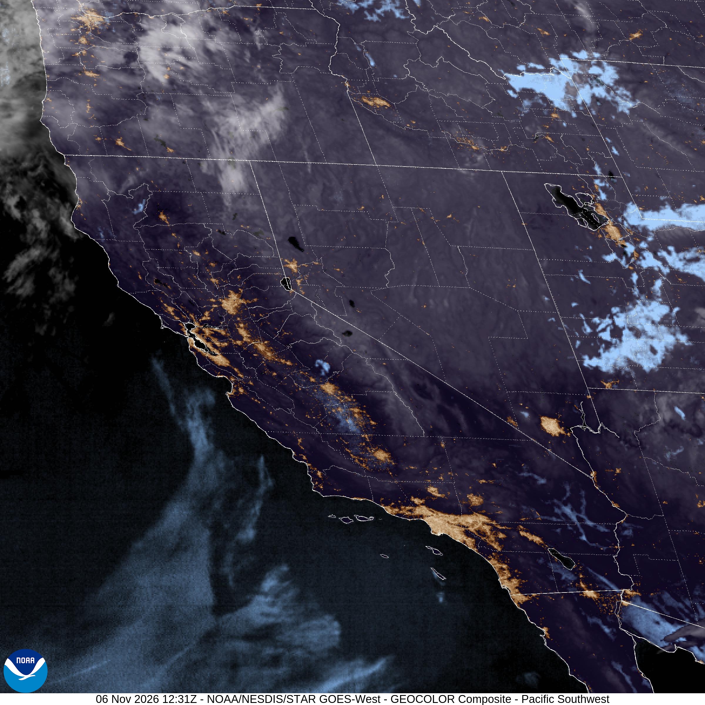
Forecasters said the episode is a weak to moderate Santa Ana wind event that will strengthen overnight Friday into Saturday. During the peak period, northeast winds of 20 to 30 mph with gusts to 45 mph are expected in typical wind corridors, with isolated gusts of 45 to 55 mph possible on exposed ridges and canyon mouths. Minimum relative humidity is forecast to fall into the 8% to 20% range Saturday, with poor overnight recoveries that keep fine fuels primed for ignition.
“There is a risk for rapid fire growth and extreme fire behavior with any new fire starts, especially late Friday night through Saturday,” the weather service said in the warning. Fuels remain critically dry despite some minor greenup from recent rains, and the office said the greatest threat will be where the driest vegetation overlaps with the strongest winds.
The City of Malibu issued a separate alert Thursday afternoon underscoring dangerous fire conditions from Friday through Sunday, with the Saturday Red Flag Warning as the core window of concern for the Santa Monica Mountains. Malibu officials said the strongest winds are expected late Friday night into Saturday, with northeast gusts of 30 to 45 mph and locally 45 to 55 mph in exposed western Santa Monica Mountains terrain. Temperatures could climb into the 80s and locally near 90 degrees Fahrenheit while humidity falls into the same critically low band cited by the weather service.
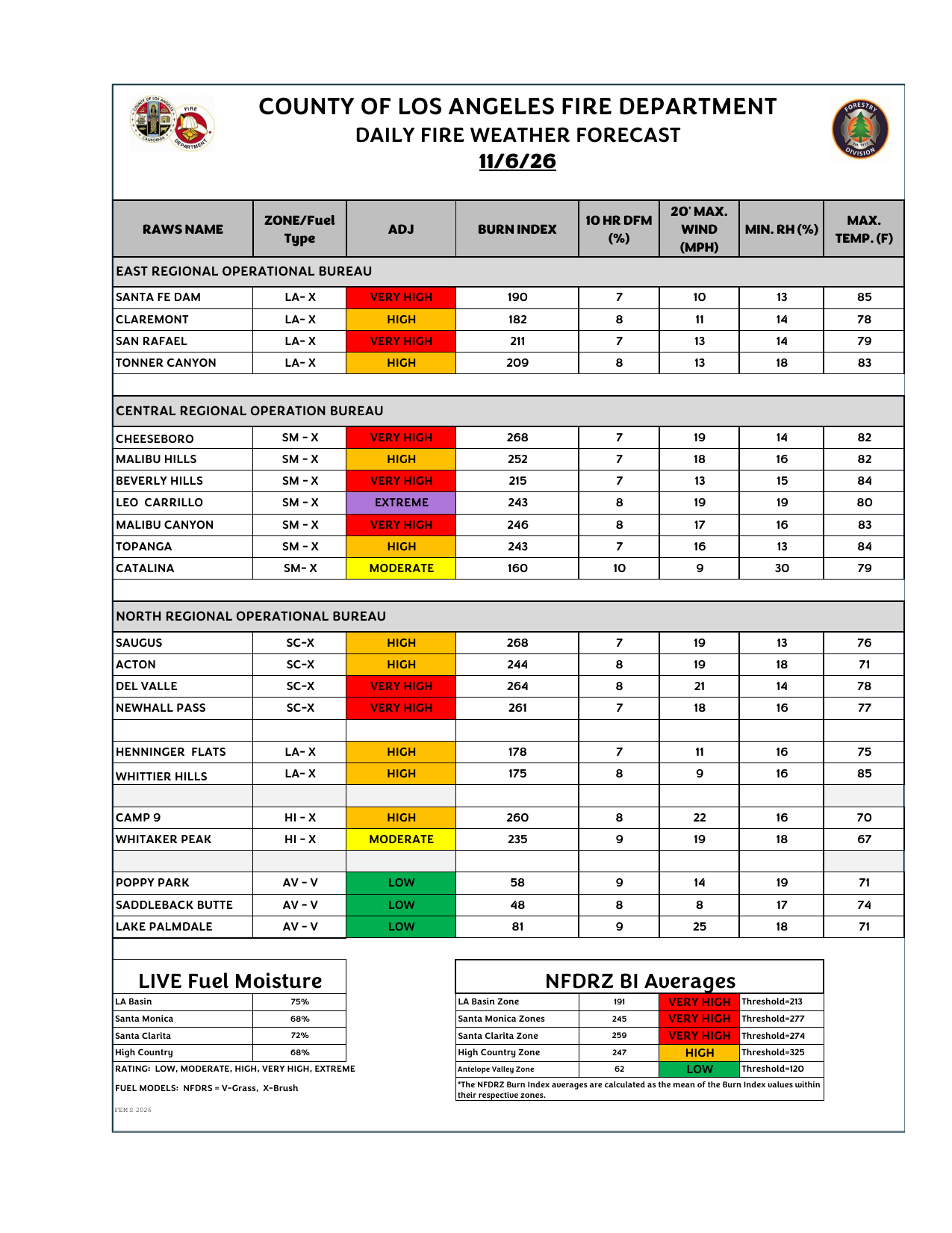
Live fuel moisture in the Santa Monica Mountains measured 68% as of Oct. 29, according to the Malibu alert and the Los Angeles County Fire Department daily fire weather forecast for Friday. County readings also listed Santa Clarita live fuel moisture at 72% and High Country moisture at 68%. Malibu officials noted that large fires can still develop when live fuel moisture sits between about 60% — a critical threshold — and 80%, especially when strong winds and low humidity arrive together. Recent rain has produced patches of green grass, they said, but much of the brush remains dry.
Los Angeles County Fire Department Remote Automated Weather Station guidance for Friday already showed elevated burn indexes and low 10-hour dead fuel moisture across Santa Monica Mountains and Santa Clarita Valley sites, including high to very high ratings at Cheeseboro, Malibu Hills, Saugus, Del Valle and Newhall Pass. Leo Carrillo was listed at an extreme adjusted rating. Those numbers help explain why Saturday’s wind and humidity forecast drew a targeted alert for the same corridors.
Southern California Edison also issued Public Safety Power Shutoff alerts for portions of the Santa Clarita Valley as a precaution against wind-driven ignition risk from utility infrastructure, SCVNews reported Thursday. Residents were directed to Edison’s outage center for the latest circuit status. Utility de-energization decisions can change with observed winds, so local officials urged households in alerted areas to prepare for possible outages even if shutoffs are not yet underway.
Warming is expected to accompany the offshore flow. National Weather Service meteorologist Rich Thompson told the Los Angeles Times that residents should expect a weak to moderate Santa Ana wind pattern developing late Thursday and lasting through the weekend, peaking Saturday with gusts commonly in the 30 to 45 mph range and isolated mountain gusts up to 55 mph in Los Angeles and Ventura counties. Thompson said widespread highs in the upper 70s and 80s are likely, with some coastal and valley locations approaching 90 degrees as the air descends and dries. Downtown Los Angeles was forecast near 87 degrees Sunday and Santa Monica near 84 in the Times report.
MyNewsLA, citing the same Oxnard forecast package, said temperatures across Los Angeles County coastal and valley areas should reach the upper 70s and 80s Saturday, generally 5 to 10 degrees above normal for early November Saturday and Sunday. The weather service also put the chance of advisory-level Santa Ana winds at 20% to 30% Friday and 50% to 70% Saturday and Sunday, highlighting that Saturday remains the focus of the formal Red Flag Warning even as breezy and dry conditions may linger around the edges of the weekend.
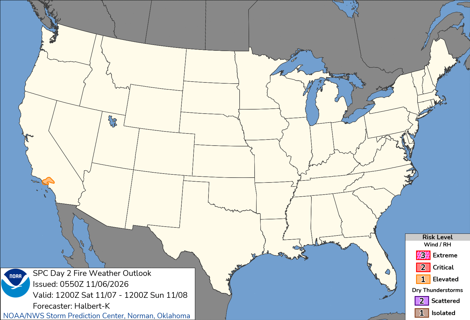
The Storm Prediction Center likewise flagged elevated fire weather for a localized slice of Southern California on its Day 2 outlook valid Saturday, citing portions of the San Gabriel, Santa Monica and Santa Susana mountains and adjacent valley terrain. Local Red Flag criteria from NWS Los Angeles/Oxnard remain the governing product for evacuation readiness and burn restrictions in the warning zones.
For residents of Santa Clarita, Canyon Country, Stevenson Ranch, Chatsworth, Calabasas, Malibu, Topanga, Agoura Hills and the Highway 14 corridor, the practical message is urgent: avoid anything that can throw a spark during the warning window. That includes outdoor welding, grinding, lawn equipment with metal blades that can strike rock, fireworks and unattended outdoor cooking. The weather service pointed residents to readyforwildfire.org and wildfirerisk.org and said people living at the wildland-urban interface should be ready to evacuate if a fire starts under critical weather.
Malibu’s alert urged residents to skip landscaping and gardening with power tools, review emergency and evacuation plans, keep go-bags ready and sign up for city and Los Angeles County alerts. Officials also recommended monitoring AM/FM radio if power fails.
Northeast Santa Ana flow accelerates through mountain passes and downslope canyons, then fans into valleys where homes and brush sit close together. The Santa Susana Mountains and Newhall Pass area can funnel winds into the Santa Clarita Valley. The Santa Monica Mountains expose ridgelines above Malibu and the 101 corridor. Western San Gabriel slopes and the Highway 14 corridor can see turbulent gusts where desert air spills toward the valleys.
Recent fire history hangs over every Red Flag Warning this season. The Los Angeles Times noted that the last Santa Ana surge helped fuel multiple fires, including the 570-acre Norte Fire in San Clemente, and that Saturday’s setup arrives with memories of the destructive 2025 Eaton and Palisades fires still fresh. Forecasters are not predicting a specific new fire; they are warning that the weather itself would favor extreme behavior if one starts.
After the weekend offshore pattern weakens, the weather service expects a gradual cooling trend through early next week. Thompson told the Times that an atmospheric river remains possible around the Nov. 13-14 weekend, though details were still uncertain Thursday. Any later rain would not reduce the immediate Saturday risk.
Until then, the forecast for the Santa Clarita Valley, Santa Monica Mountains, Santa Susana Mountains and western San Gabriels is clear: warm, dry and windy Saturday under a Red Flag Warning from 2 a.m. to 6 p.m. PST, with the highest concern for new starts late Friday night through Saturday afternoon.
