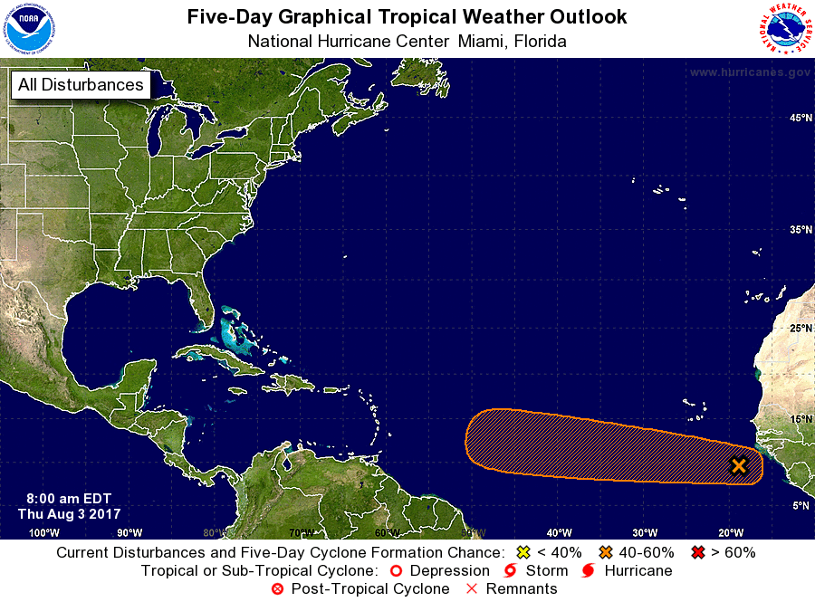
The National Hurricane Center (NHC) is monitoring a new area in the Atlantic Hurricane Basin for potential tropical cyclone development. A large area of showers and thunderstorms centered about 500 miles southeast of the Cabo Verde Islands is associated with a vigorous tropical wave. According to the NHC, environmental conditions are forecast to be conducive for gradual development, and a tropical depression could form by early next week over the eastern or central tropical Atlantic Ocean. This system is forecast to move toward the west or west-northwest at 10 to 15 mph for the next several days.
The NHC believes there’s a low chance of development over the next 48 hours (30%), but a moderate chance (60%) of development over the next 5 days.
The Atlantic basin has been busy, with named storms Arlene, Bret, Cindy, Don, and Emily already forming and dissipating this season. The next named storm in the Atlantic would be called Franklin.
Experts believe this Atlantic Hurricane Season, which runs through to the end of November, will be a busy one. Dr. Phil Klotzbach and the experts at Colorado State University updated their seasonal outlook again on July 5, showing a much more active than normal season expected. The National Oceanic and Atmospheric Administration (NOAA) also released their own forecast which shows this hurricane season to be likely more active than others.