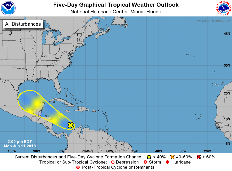
The National Hurricane Center (NHC) is monitoring an area of potential trouble in the tropics. Over time, there is a chance that a tropical cyclone could impact the Gulf of Mexico, although the NHC pegs those odds relatively low for now.
The area of concern is off the Central American coast at this time. A broad area of showers and thunderstorms has persisted over the southwestern Caribbean Sea for the past several hours. This activity is associated with a tropical wave over northwestern Venezuela and a surface trough located just east of Nicaragua interacting with a large upper-level trough. Little development of this area of disturbed weather is expected over the next few days due to interaction with Central America and the Yucatan Peninsula. However, environmental conditions could become somewhat more conducive for some limited development when the system moves into the southwestern Gulf of Mexico by the end of the week.
Some computer forecast guidance, such as earlier runs of the American GFS forecast model, have suggested that this system would develop into a US-threatening tropical storm or hurricane. However, such model guidance has backed off on such a severe solution. Regardless of development, this disturbance will produce locally heavy rainfall across portions of Nicaragua, Honduras, Belize, Guatemala, and the Yucatan Peninsula through Thursday. And even if a tropical cyclone doesn’t take shape, heavy rain and gusty winds are still a possibility for the Gulf of Mexico next weekend.
While no tropical cyclone is threatening the United States at this time, experts encourage Americans to prepare a Hurricane Action Plan and to have basic supplies set aside now that hurricane season is here. The hurricane season runs through the end of November.