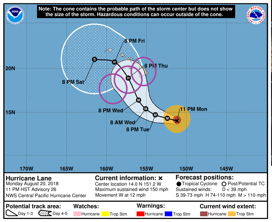
Major Hurricane Lane, a powerful Category 4 Hurricane, could bring catastrophic, destructive impacts across the Aloha State later this week; everyone across the entire Hawaiian Island chain should rush their Hurricane Action Plan efforts to completion as soon as possible. Based on the latest forecast track issued by the Central Pacific Hurricane Center (CPHC), Hurricane Lane could impact Hawaii as soon as Wednesday evening on Hawaii’s Big Island with impacts elsewhere along the chain likely for the balance of the week.
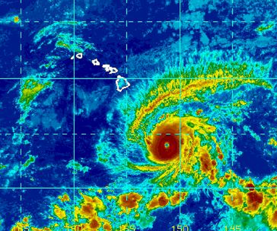
As of the 11pm HT / 5am ET update from the CPHC, the eye of Hurricane Lane was located by aircraft near latitude 14.0 North, longitude 151.2 West. Lane is moving toward the west near 12 mph and this motion is expected to continue through Tuesday, with some slowing in forward speed. A gradual turn toward the northwest is expected Wednesday into Thursday. Maximum sustained winds are near 150 mph with higher gusts. Lane is a strong category 4 hurricane on the Saffir-Simpson Hurricane Wind Scale. Hurricane-force winds extend outward up to 40 miles from the center and tropical-storm-force winds extend outward up to 125 miles. The estimated minimum central pressure is 950 mb (28.06 inches).
Top sustained winds in Major Hurricane Lane are only 7mph short of it becoming a top-of-the-chart Category 5 hurricane.
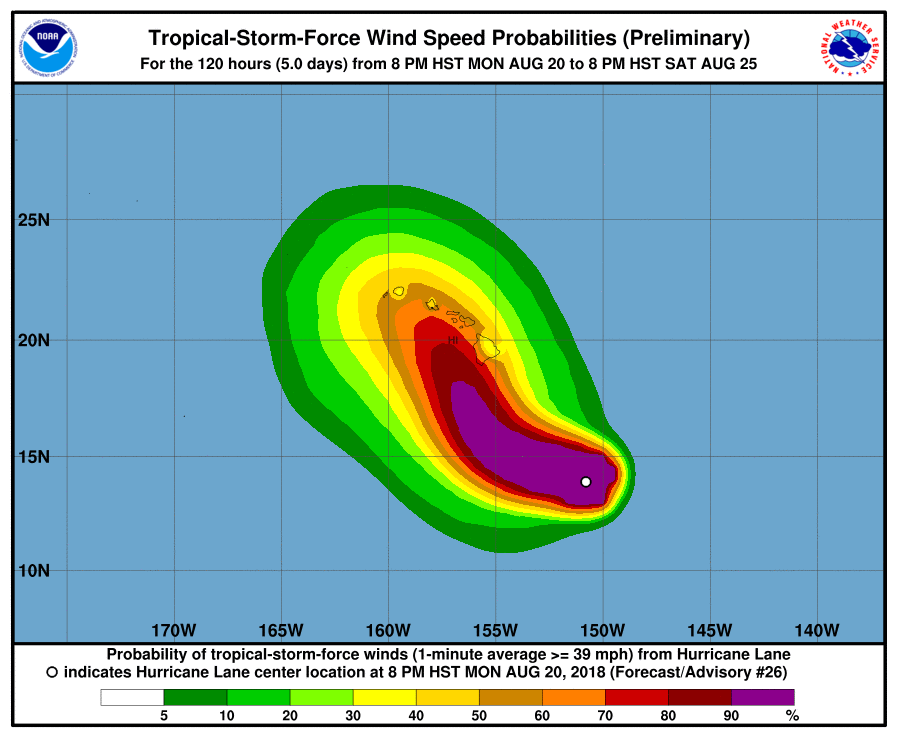
Everyone on Hawaii, resident or visitor, should prepare for significant impacts from this storm. While the exact track is not yet known, confidence is increasing in a track that would produce severe impacts state-wide. Impacts from a tropical cyclone like a hurricane extend far from the center of the storm; even if the center doesn’t cross an island in Hawaii, the impacts could be potentially catastrophic in the state.
While odds are increasing of severe winds in the islands, the biggest threat remains incredibly heavy rains. Some computer guidance is suggesting the possibility of a foot or more of rain across all of the major islands. Such heavy rain could trigger rock or mud slides, road wash-outs, and flash-flooding in rural and populated areas. While such catastrophic flooding is not yet imminent, people should make plans and know what to do should such heavy rains materialize on their island and in their community.
Beyond heavy rain and damaging winds, rough surf and storm surge flooding could also be possible. People in low-lying coastal areas across the state should review their evacuation plans and be ready to flee for safer ground should a storm surge occur. Even without a direct hit by Lane, rough dangerous surf will continue to build across the state, making conditions dangerous for even the most experienced swimmers and surfers.
The Central Pacific Hurricane Center has yet to issue Hurricane or Tropical Storm Watches for Hawaii, but this could change Tuesday morning. Because hurricane preparedness activities become difficult once winds reach tropical storm force, the hurricane watch is issued 48 hours in advance of the anticipated onset of tropical-storm-force winds. With such winds arriving late Wednesday or early Thursday, a watch would need to be issued by Tuesday morning.
