• Skip to primary navigation
  • Skip to main content
  • Skip to primary sidebar

Weatherboy

Weatherboy Weather News, Maps, RADAR, Satellite, and Forecasts.

  • Local
  • Earth Science News
  • RADAR
  • Current Warnings
  • Satellite
  • Current Maps
  • Forecast Maps
  • Video

Fire Spreads Ash, Smoke onto Weather RADAR

by Weatherboy Team Meteorologist - March 31, 2019

Weather RADAR shows area of particulates rising from a fire in Burlington County, New Jersey. Image: NWS


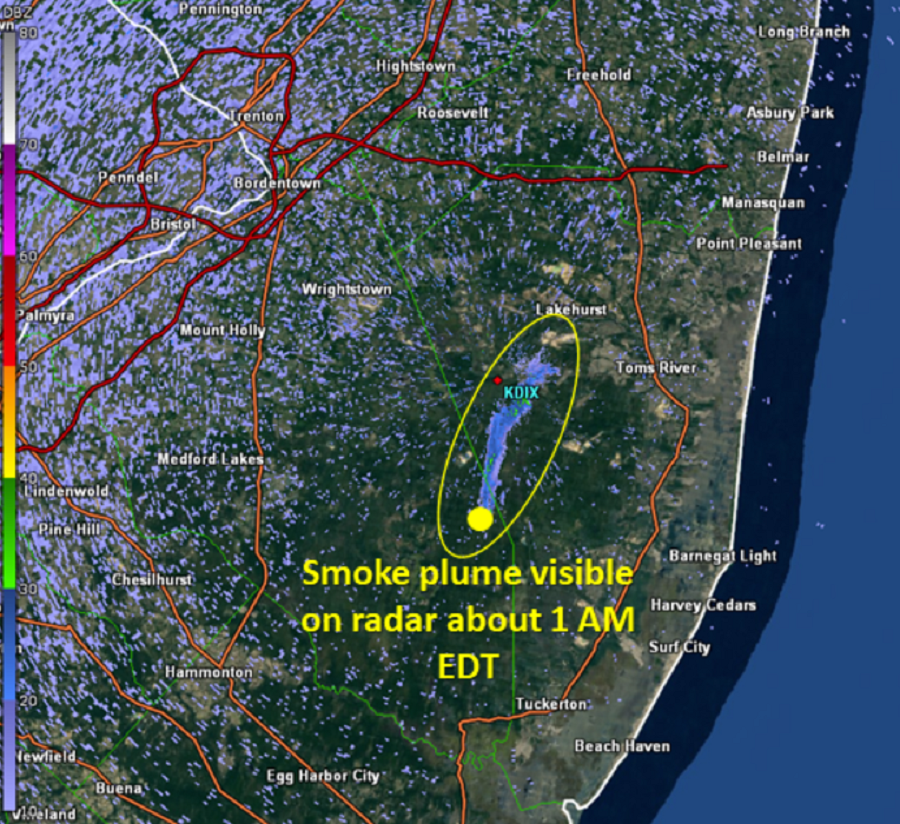
A large fire burning in New Jersey is spreading ash and smoke as far away as New York; it’s also leaving clear signals on weather RADAR. The fire, which sent plumes of black smoke visible in several counties, was first reported at 1:45pm in Penn State Forest in Woodland Township, Burlington County. The fire grew to 5,000 acres by 10pm last night and has now consumed just over 10,000 acres as of this afternoon. Fortunately, firefighters at the scene now consider the fire 75% contained.


Red circled area on this RADAR map indicates debris from the Southwest jet in the sky over eastern Pennsylvania. Image: NOAA/NWS
While people as far away as Staten Island, New York, have reported ash and smoke from the fire, and people throughout the Garden State have reported smelling the smoke from far away, another place the smoke is visible is on weather RADAR. National Weather Service weather RADAR has been able to capture the big plume of smoke as it rises into the sky from near the Burlington / Ocean County border.

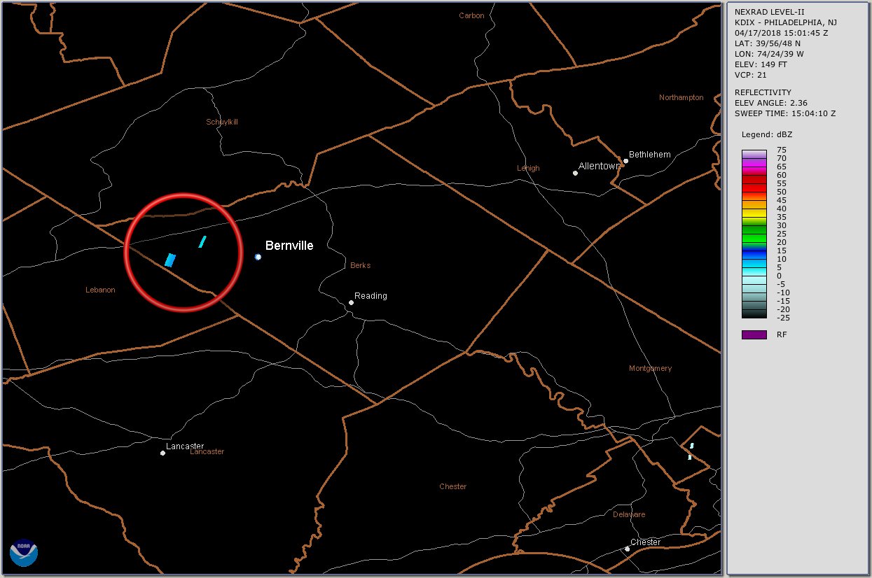
Beyond tracking precipitation, weather RADAR can be used to track other objects in the air. In 2018, the same RADAR unit showing today’s smoke helped locate a part of a Southwest Airlines jet that broke-off in flight over Pennsylvania. Other times, RADAR has shown bugs, bats, and birds. In the 2003 Space Shuttle Columbia disaster, RADAR was able to show the debris field from the disintegrating shuttle across portions of Texas and Louisiana.

Primary Sidebar

Sponsored Ad

Search

Latest News

  • Tropical Chantal Moves Inland, Soaking Mid Atlantic
  • Tropical Storm Warnings Issued as Chantal Approaches East Coast
  • Tropical Storm Watches Issued for East Coast as Tropical Depression Forms
  • System to Impact Southeast U.S. This Weekend Says National Hurricane Center
  • Hurricane Center Says East Coast System Likely to Develop
  • National Hurricane Center Increases Odds of Cyclone Development Near Florida
  • Severe Weather Outbreak Likely in Mid Atlantic
  • July to Start with Severe Weather Event in New Jersey, Pennsylvania, Delaware, & Maryland
About | Careers | Contact | Contests
Terms | Privacy | Ad Choices
Weatherboy is a (R) Registered Trademark of isarithm LLC, All Rights Reserved.
All content herein is Copyright by Isarithm LLC 1997-2022