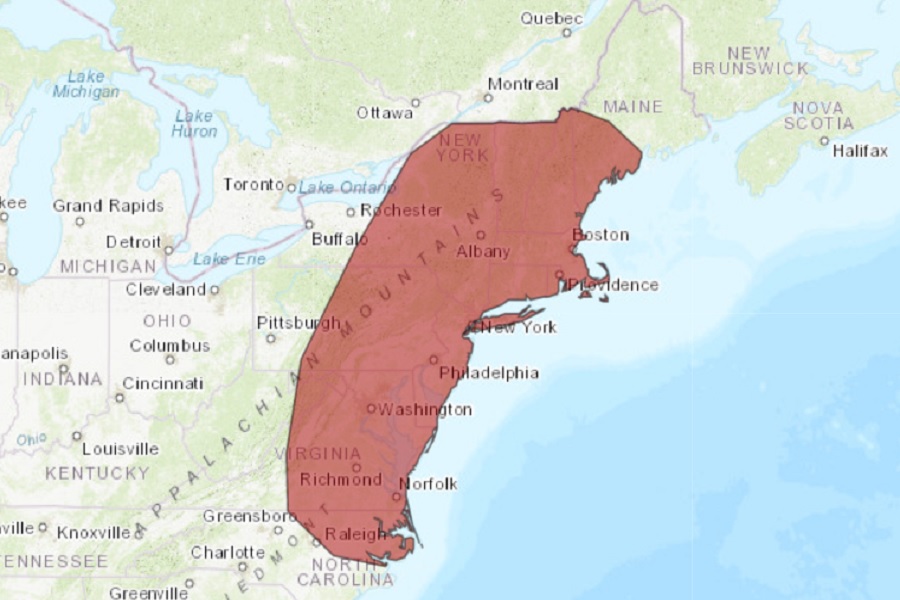
While the spring season started on a significantly cool start in large parts of the eastern U.S. this year, it appears the Northeast and Mid Atlantic are about to be blasted by unseasonably hot conditions in the coming days. The National Weather Service is warning that the combination of high air temperatures and high humidities could lead to dangerously hot conditions from northern North Carolina across eastern Virginia, all of Maryland, Delaware, New Jersey, Connecticut, Rhode Island, Massachusetts, New Hampshire, Vermont, the eastern two-thirds of New York and Pennsylvania, and portions of southeast Maine.
The Heat Index, also known as the Apparent Temperature, is a subjective measure of what it feels like to the human body when relative humidity is factored into the actual air temperature. Relative humidity is a measure of the amount of water in the air compared with the amount of water that air can hold at the current temperature. In short, it’s a measure of how close the air is to being saturated with moisture. The body cools itself through the evaporation of perspiration or sweat. However, when the relative humidity is high, the increased moisture content in the air decreases the evaporation of perspiration or sweat. Therefore, the body feels warmer when it’s humid.

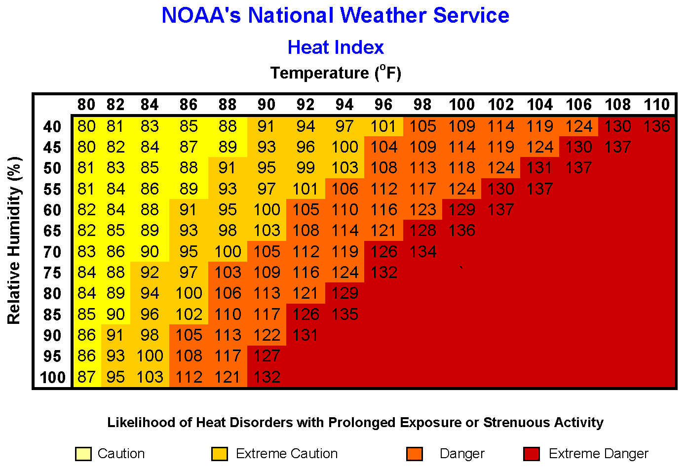
As an example, in the heat index chart presented here, a hot and very humid air mass with a temperature of 94 degrees and a relative humidity of 45 percent yields an apparent temperature of 100 degrees . Holding the temperature constant and increasing the relative humidity to 60 percent yields an apparent temperature of 110 degrees.
According to the National Weather Service, an area of Excessive Heat will develop over parts of the Southern Plains, Central Gulf Coast, and Lower Mississippi Valley on Friday and Saturday. During this period, the excessive heat is due to upper-level ridging, dew point temperatures in the upper-sixties to low-seventies, high temperatures in the upper-nineties to mid-hundreds, and heat indices of 110 to 115. A second area of Excessive Heat
will develop over parts of the Northeast to the Mid-Atlantic from Friday into Sunday. The Excessive Heat will develop over this highly populated portion of the country due to upper-level ridging and high temperatures ranging from the mid to upper-eighties over the Northeast to mid to upper-nineties over the Mid-Atlantic on Friday. On Saturday, the high temperatures will range from the low to mid-nineties over the Northeast and Mid-Atlantic. However, on Sunday, the temperatures will begin to moderate with high temperatures in the mid to upper-eighties over the Northeast and the upper-eighties to low-nineties over the Mid-Atlantic.
The blast of high temperatures and humidity levels more common in early July than mid May will be relatively brief, with near-normal conditions arriving as a cold front pushes through the region. After the frontal passage late Sunday, temperatures should tumble in the northeast by about 20 degrees on Monday, restoring temperature and humidity levels to those more common for this type of year.