Image: NWS
A powerful hurricane-force bomb cyclone as part of a Pineapple Express event is set to surge a plume of moisture and damaging winds into the
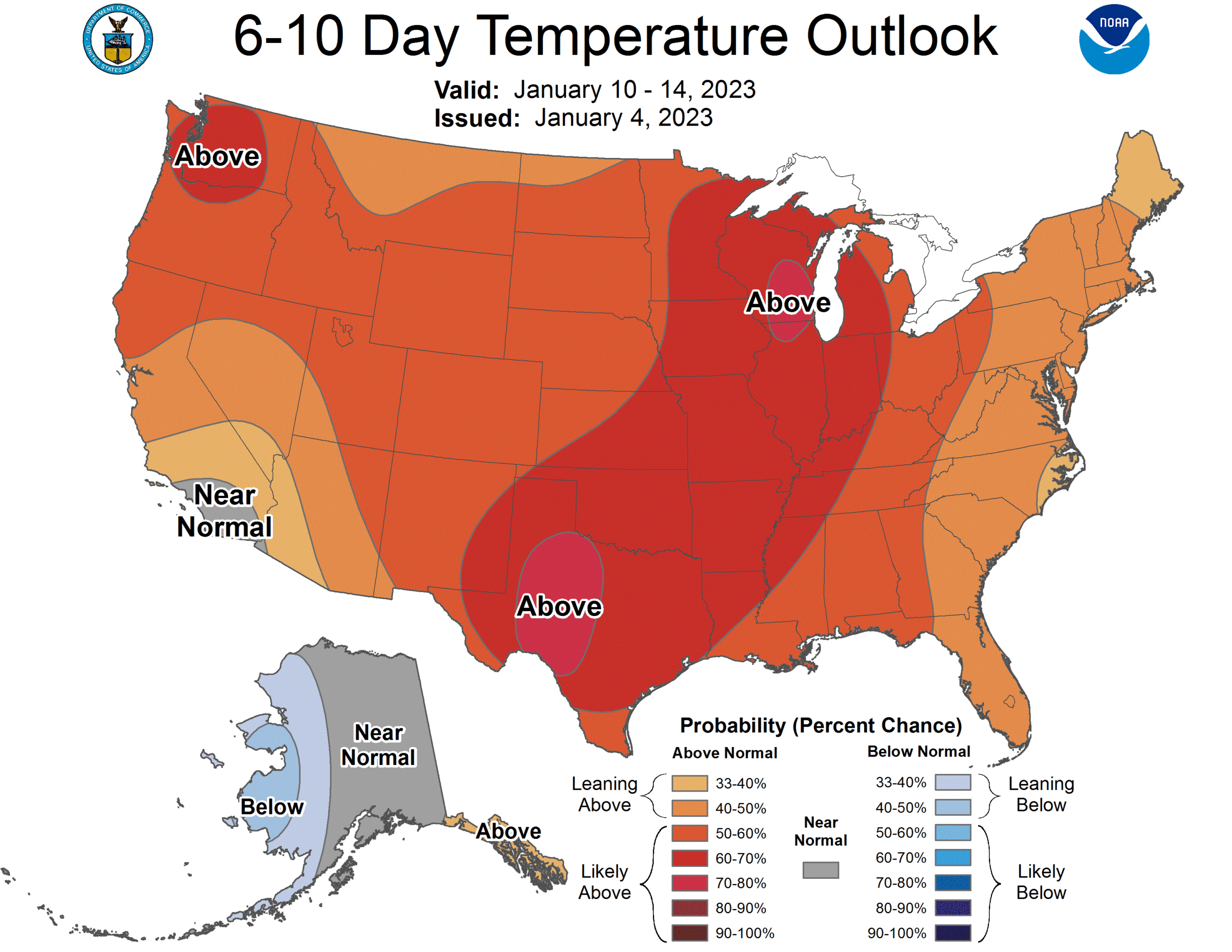
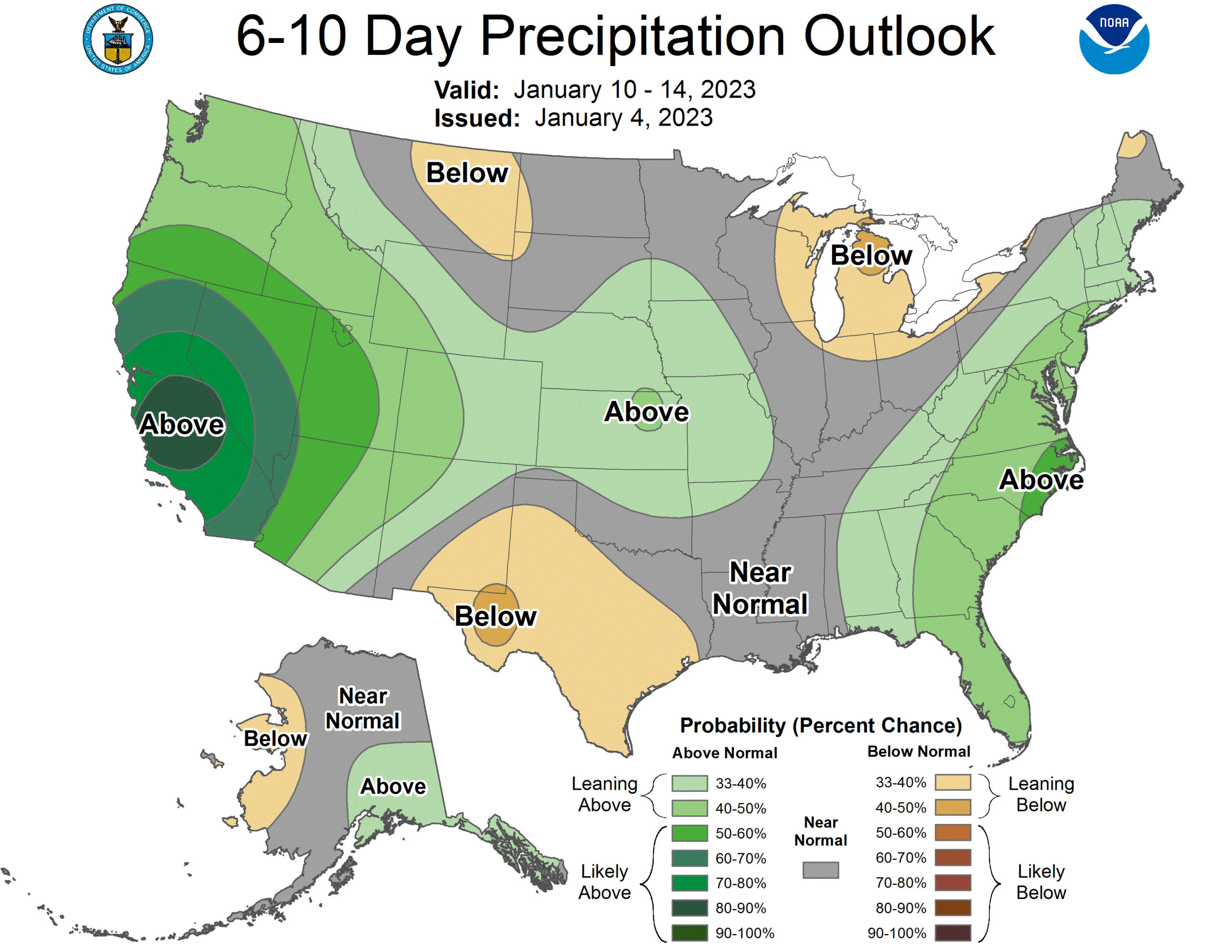
West Coast beginning tonight. But in the long-term, this storm system will also help much of the U.S. go into a warm-up phase over the next week, with above normal temperatures expected across a large part of the country.
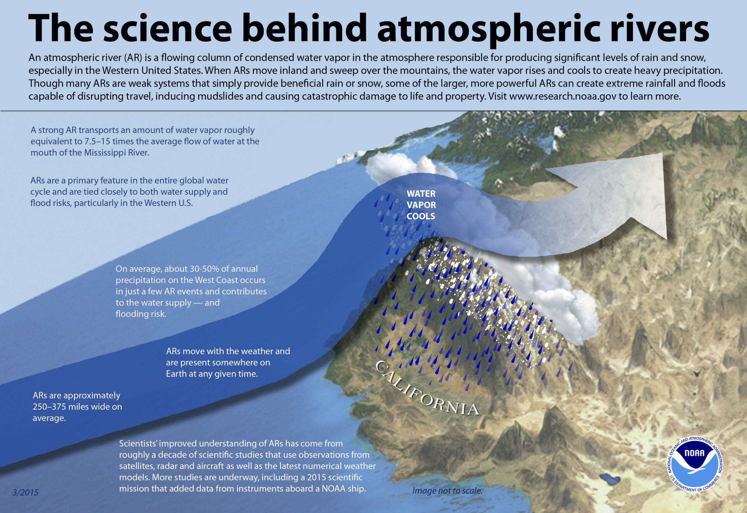
The greatest impacts from this Pineapple Express Atmospheric River event in the short-term will include damaging winds, excessive rainfall, and extremely heavy snow over much of California and into southern Oregon through Thursday. Widespread rainfall amounts of 3-6″, with locally higher totals, occurring within a relatively short period of time will have the potential to lead to several instances of flooding throughout the already saturated region. The highest precipitation amounts are expected to occur over the coastal ranges of California as far south as the Transverse Ranges and throughout the Sierra foothills.
Recent burn scars and other sensitive terrain will have the greatest chances for rapid runoff and mudslides as rain rates potentially exceed 1″/hour.
For the high terrain of the Sierra Nevada, precipitation will fall mostly as snow and add up to at least 3 feet over the peaks. Gusty winds will add to the hazardous heavy snow, resulting in potential tree damage and white out conditions.
Strong southerly winds will occur across the remainder of the region as well, with rough surf along the coast and potentially damaging winds spreading into the central valley. High winds combined with saturated ground conditions could lead to additional downed trees and resulting power outages. Flood and Flash Flood Watches, High Winds Warnings, and Winter Storm Warnings are in effect from southern Oregon to southern California. Residents and visitors are urged to check their local forecast before traveling and prepare for potential power outages and/or
flooding impacts.
The next system to impact the Golden State is anticipated to spread heavy rain into northern California by Friday night, which could lead to additional flooding concerns.
With these Atmospheric River events plowing into California, the jet stream will take on a zonal flow across much of the U.S., keeping most cold air locked in Canada while helping bring up milder air from southern areas north. Until the fire-hose-like stream of moisture stops in the West, it’s unlikely winter storms and cold air will be able to take a hold on the East.
