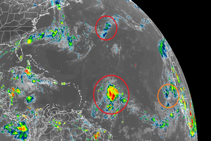
After an exceptionally quiet August Atlantic Hurricane Season, it appears likely that two new tropical cyclones will form soon in the basin, perhaps within the next 2-3 days. There are three areas of concern in the Atlantic that the Miami, Florida-based National Hurricane Center (NHC) are being monitored for potential development; of them, it is now likely two will form into a tropical cyclone within the next five days.
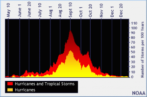
September 10 is the traditional peak of the Atlantic Hurricane Season and often the weeks leading up to it show an increase in activity –except for this year. The 2022 Atlantic Hurricane Season is breaking records for how inactive it is. For the first time since 1941, there have been no named storms in the Atlantic Hurricane Basin from July 3 through today. 2001 started similarly quiet, with no hurricanes until September 8 in that season. 2001 eventually ended up with 9 hurricanes. Forecasters remind people that it only takes a single hurricane event to create a catastrophe.

The area of greatest concern in a low pressure system located several hundred miles east of the Lesser Antilles. A NOAA aircraft reconnaissance mission explored the region earlier today and saw little change in organization of that system. The NHC says that while environmental conditions are only marginally conducive for development, additional development is expected and a tropical depression is likely to form within the next few days. For now, the disturbance of forecast to move slowly west-northwestward, towards the adjacent waters of the northern Leeward Islands. The NHC says there’s a 60% chance that a tropical cyclone will form here within the next 48 hours; those odds grow to 80% over the next five days.
Another system shows promise of developing into a tropical cyclone, but is unlikely to impact land as it does so. Within the central Subtropical Atlantic, an area of low pressure is showing signs of organization about 850 miles west-southwest of the westernmost Azores. Environmental conditions are expected to be conducive for development, and the NHC says that a tropical or subtropical depression is likely to form within the next day or so, while the system drifts generally eastward. Right now there’s a 70% chance of tropical cyclone formation over the next 48 hours and a 80% chance that one will form over the next five days.
The third area of concern is over the eastern Tropical Atlantic. Showers and thunderstorms associated with a broad area of low pressure located just to the northeast of the Cabo Verde Islands have changed little since earlier today. According to the NHC, some gradual development is possible, and the system could become a short-lived tropical depression over the far eastern Atlantic during the next
couple of days. By late this week, environmental conditions are forecast to become increasingly unfavorable for further development. Regardless, the system could bring locally heavy rainfall to portions of the Cabo Verde Islands through Thursday. Of the three systems, this is the least likely to develop; the NHC says there’s only a 40% chance of tropical cyclone formation over the next 48 hours and only a 50-50 chance of development over the next 5 days.
The 2022 Atlantic Hurricane Season runs through to the end of November.