
Subtropical Storm Alberto hit the Florida panhandle, bringing gusty rain showers to the area. Never able to completely transform into a truly tropical cyclone, the storm system has soaked Florida with inches of rain over the weekend. A subtropical storm contains tropical storm force winds, but lacks a lot of the structure tropical cyclones have, such as spiraling concentric bands of heavy showers and strong winds.
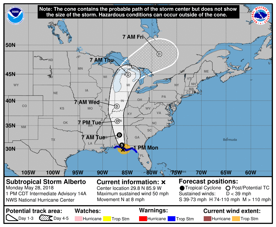
As Alberto moves further inland, it will weaken quickly. However, numerous weather hazards remain for Florida and elsewhere in the southeastern US. Heavy rainfall will lead to a significant risk of flash flooding across the Florida Panhandle, much of Alabama, and western Georgia through tonight, spreading northward into northern Georgia, the western Carolinas, and Tennessee on Tuesday. A risk of flooding and flash flooding will continue over central Cuba, the Florida Keys, and southern Florida today. Hazardous storm surge is possible along portions of the eastern Gulf Coast today, including areas well east of the track of Alberto’s center. Residents in the storm surge watch area are encouraged to follow guidance given by their local government officials. Tropical storm conditions are likely within portions of the tropical storm warning area today. Dangerous surf and rip current conditions will continue to affect portions of the eastern and northern Gulf Coast through Tuesday.
Alberto provided a jump-start to the 2018 Atlantic Hurricane Season which doesn’t officially start until June 1. While Alberto started the season early, there are no other disturbances of concern anywhere else in the Atlantic basin. According to the National Hurricane Center, no other tropical cyclone formation is expected at least through the next five days.
