The forecast for the eastern United States sounds like a broken record: yet another soaking rainstorm will bring heavy rain from Florida to Maine. Rain could be especially heavy across portions of Virginia, Maryland, Delaware, New Jersey, New York, Rhode Island, and Connecticut. As this soaking rain storm exits, there could be enough of a change in the weather pattern to produce more snow than rain when the next system pushes east around New Year’s Eve.
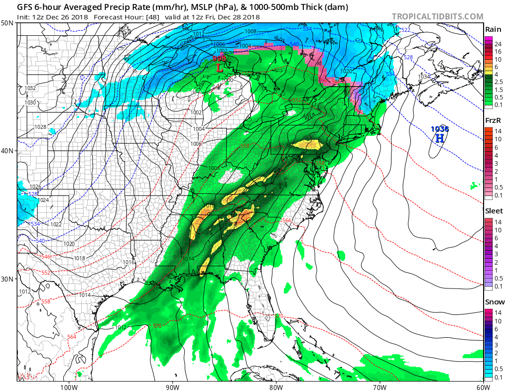
This next system will affect the East coast Thursday night and into early Friday night as low pressure moves through the Great Lakes region. The low’s associated moisture plume and fronts will reach the coast, producing soaking rains as a result. While some limited areas across the southern Poconos, central Adirondacks, and the higher elevations of New England may start out with some sleet or even freezing rain, most precipitation associated with this storm system will fall primarily as rain. Another 0.75 – 2″ of rain is possible, adding on top of already broken records for annual heavy rainfall. This additional round of rain could trigger another round of floods, a threat the National Weather Service continues to analyze. At this time, there are no widespread flood related advisories up for the eastern U.S. but that could change over time.
High pressure will rebuild into the eastern U.S. late Friday into Saturday, providing fair and dry conditions to the coast after a wet end. A cold front will pass through to the northeast coast on Saturday, setting the stage for an interesting wintry scenario on New Year’s Eve.
Just enough cold air may be around to produce more snow than rain as a new system pushes through the Mid Atlantic and Northeast on Monday. While it is still too soon to say with certainty who will get snow and how much of it they’ll get, there is a chance that accumulating snowfall may fall in places like New York City before the ball drops New Year’s Eve night. Another round of wintry precipitation is also possible later next week, but it’s track will be dependent on what happens with the New Year’s Eve event.
