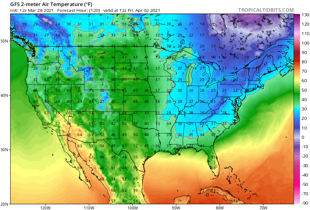
Hopefully you didn’t get fooled by recent warm weather to plant sensitive vegetation: it appears Old Man Winter will be making a visit in parts of the country, with a deep freeze likely at the start of April.
A cold front will move across the east coast Wednesday into Wednesday night, followed by a secondary cold front or surface trough on Thursday. While the initial front could set-off another round of soaking rain and strong to severe thunderstorms in the eastern U.S., the secondary front will help eventually usher dry and much colder air into the northeastern quarter of the country.
The wet-weather front is forecast to move offshore overnight Wednesday into Thursday, while an area of low pressure moves out of New England and into southeastern Canada. This will turn the flow to the northwest, opening the virtual floodgates of cold Canadian air into the northeast. Winds will become quite gusty between the low to the north and high pressure
across the central part of the country, helping bring those colder conditions more south. Winds could gust 20-30 mph
at times.
The frontal passage on Thursday will also help wring-out moisture, creating more scattered rain showers for some. With cold air arriving, some of those rain showers could mix with or change to plain snow, especially from northern Pennsylvania and northern New Jersey and points north. All precipitation should come to an end Thursday night as drier air moves in; the dry weather will persist for Friday into the weekend as high pressure builds out of the Ohio River Valley Friday and then across the southeast states Saturday.
People with plants and animals that are sensitive to cold temperatures should plan for the cold snap, taking precaution to protect them from temperatures expected to drop near or below freezing. Beyond living things, people should also make sure that other outdoor equipment, such as irrigation systems, is also ready to deal with the coldsnap.
