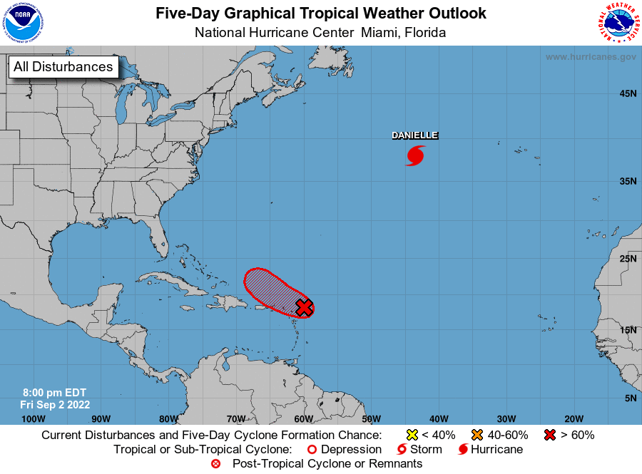
After a very quiet summer in which no hurricanes formed in the Atlantic in July nor August, things are perking-up in the basin with Hurricane Danielle spinning about and a new potential tropical storm on the way. The National Hurricane Center (NHC) in Miami, Florida is not only monitoring Hurricane Danielle, but another system near the Caribbean that they say could become a tropical storm very soon.
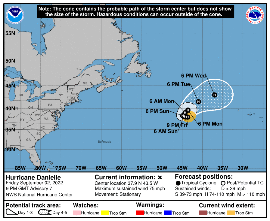
Hurricane Danielle is currently over the open waters of the central North Atlantic and is expected to sit there for a while. As of the latest NHC advisory, it was located about 895 miles west of the Azores well east of Bermuda. With a minimum central pressure of 992 mb, Danielle has maximum sustained winds of 75 mph. The storm is stationary and the latest NHC forecast says it is expected to meander over the open Atlantic during the next couple of days. Then, Danielle is forecast to slowly turn toward the northeast early next week. As it spins about, it could gain some more strength over the next few days. Even so, it shouldn’t threaten any land.
Danielle’s future path could help steer a new disturbance that appears to be taking shape east of the Leeward Islands.
According to the NHC, data from an Air Force Reserve Hurricane Hunter aircraft earlier this afternoon indicated that the circulation associated with an area of low pressure located a couple of hundred miles east of the northern Leeward Islands has become better defined today, and the plane reported that surface pressures have fallen a bit. According to the NHC, if the showers and thunderstorms associated with the low persist through the evening, the system could become a tropical depression or tropical storm as early as tonight. Right now, the NHC believes there’s a high 80% chance that tropical cyclone formation will occur here within the next 48 hours, if not sooner.
This development system is forecast to move generally west-northwestward at about 10 mph, passing near or just to the north of the northern Leeward Islands on Saturday, and north of the Virgin Islands and Puerto Rico Saturday night and Sunday. Regardless of development, locally heavy rains may occur over portions of the northern Leeward Islands, the Virgin Islands, and Puerto Rico during the next couple of days.
Where it goes next could be driven by Danielle, which will either create a pattern that grabs the new disturbance east with it or will move quickly enough to the east to allow for high pressure to build in behind it, which could help steer this new system towards the United States southeast coast. It is still far too early to assess what the final path of this storm could be, especially with it not being completely formed yet.
But if the new area does develop into a tropical storm, the National Hurricane Center would name it Earl.
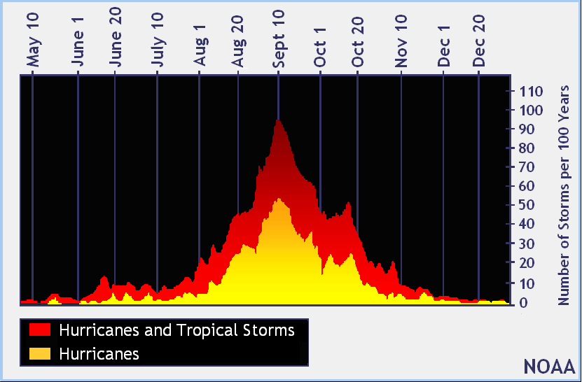
While no other tropical storms or hurricanes are expected to form beyond this system, the Atlantic is nearing the September 10 traditional peak of the season. As such, it is statistically likely that more systems will form in the coming weeks which could threaten the U.S..
The 2022 Atlantic Hurricane Season runs through to the end of November.
