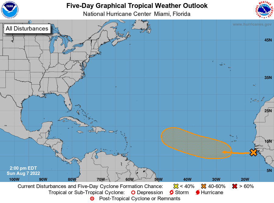
According to the latest Tropical Outlook issued by the National Hurricane Center in Miami, Florida, a system in the Atlantic shows some promise for becoming the next new tropical cyclone inside the Atlantic Hurricane Basin.
For now, a tropical wave located near the west coast of Africa is producing disorganized showers and thunderstorms over the far eastern tropical Atlantic. Satellite images continue to show the area of clouds and showers drifting around near the coastline.

However, according to the National Hurricane Center, environmental conditions appear generally conducive for gradual development of this system while it moves westward to west-northwestward at 15 to 20 mph across the eastern and central tropical Atlantic. In fact, the National Hurricane Center now says that a tropical depression could form around the middle to latter part of the coming week. While the National Hurricane Center says there’s nearly a zero chance of formation over the next 48 hours, they say there’s a medium chance –roughly 40%– that a system will develop here over the next 5 days.
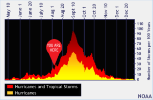
The Atlantic Hurricane Basin has been quiet the last two months, which is typical of most hurricane seasons. The peak of the season usually arrives during the second week of September, with activity surging in the weeks right before and after then in terms of volume of tropical storms and hurricanes.