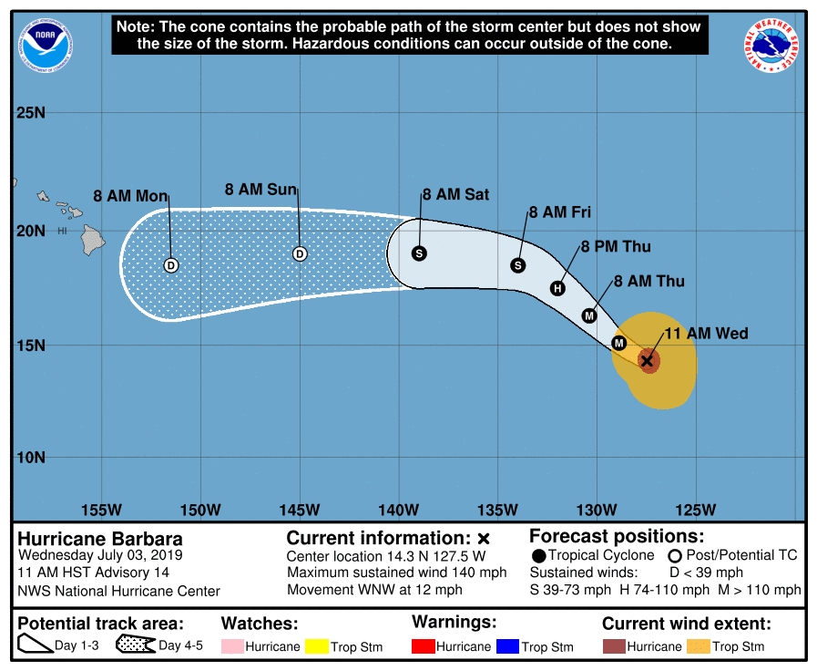
Hurricane Barbara is losing some of its steam and significant weakening is forecast over the next 48 hours; however, it is becoming more likely that there could be some direct, significant impacts to Hawaii early next week.
Satellite images indicate that Barbara has continued to gradually weaken. The eye is not as distinct as it has been during the past 24 hours, and the cloud tops surrounding the eye have warmed. According to the National Hurricane Center (NHC), Barbara’s circulation is beginning to move toward cooler waters so a gradual weakening trend should prevail; faster weakening is anticipated once the shear increases significantly in about 2 days. In fact, Barbara could lose its deep convection, and thus become post-tropical, around the time it is forecast to cross 140W into the central Pacific basin. When Barbara crosses this line, the Central Pacific Hurricane Center will assume forecasting responsibility of it from the National Hurricane Center.
For now, Barbara is moving toward the west-northwest at 10 kt. The hurricane has reached the southwestern edge of the subtropical ridge, and this flow pattern should steer Barbara on a northwest track during the next 2 days or so. After that time, a new ridge is forecast to build north of the cyclone, resulting in a turn back toward the west. In addition, since Barbara is forecast to become a weak and shallow cyclone, it will likely become steered westward by the low-level trade winds by Saturday.
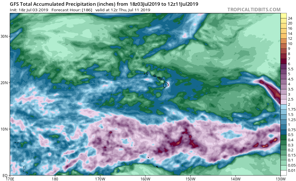
Early next week, global computer forecast guidance such as the American GFS and European ECMWF have been consistent in bringing what’s left of Barbara to Hawaii. While it’s unlikely it’ll have any structure like a tropical cyclone when it arrives, it will still have a very large amount of precipitable water. When interacting with the higher terrain of Hawaii, especially Maui and Hawaii county, this moisture-rich environment could rain-out, dumping potentially life-threatening flash flooding rains in Hawaii. The greatest threat of floods will be on the east-facing sides of the islands. While such a flood threat won’t likely arrive until after Monday, it is important residents and visitors in Hawaii prepare for the possibility of flooding and flood damage, especially in flood prone areas next week.
