
A powerful blizzard continues to march east through Colorado and Wyoming, bringing high winds and heavy snow to portions of the West. In addition to very heavy snow, very heavy rain has been falling in the storm system’s warm sector.
In the last 24 hours ending 8am this morning local time, 6″ of rain fell in southern Nebraska while more than 52″ of snow (4’+) fell in eastern Wyoming. More heavy precipitation is expected tonight into tomorrow.
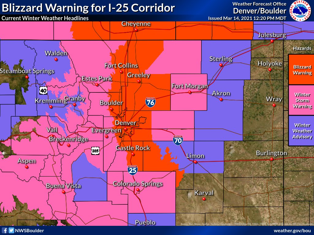
According to the National Weather Service office in Boulder, Colorado, difficult if not impossible travel can be expected across the Front Range and I-25 Corridor through this evening due to blizzard conditions.
The significant late season winter storm centered over southeast Colorado will nearly stall today, and then lift slowly northeast and weaken tonight. Significant snow accumulations have already occurred across the Front Range Mountains and Foothills, with a few spots already seeing greater than 2 feet, and well over a foot in the Fort Collins area. Snow will be heavy at times through the day in and near the Front Range and I-25 Corridor. The most severe conditions from deep accumulating snow will likely occur in and near the Front Range Mountains and Foothills where totals of 2-4 feet can be expected, and along the I-25 Urban Corridor where 1-2 feet will likely fall. The favored locations for the heaviest snow totals along the I-25 Corridor will be from Boulder north through the Fort Collins area.
Temperatures will be warm enough to bring a mix of rain and snow across the plains mainly east of a Sterling to Limon line.
Winds will gust to between 35 and 45 mph, producing significant blowing and drifting snow and blizzard conditions across the I-25 Corridor.
People are urged to stay indoors and avoid roads during the significant storm.
