• Skip to primary navigation
  • Skip to main content
  • Skip to primary sidebar

Weatherboy

Weatherboy Weather News, Maps, RADAR, Satellite, and Forecasts.

  • Local
  • Earth Science News
  • RADAR
  • Current Warnings
  • Satellite
  • Current Maps
  • Forecast Maps
  • Video

Blizzard Warnings Persist in Hawaii & Alaska While Snowstorm Threat Grows in Northeast

by Weatherboy Team Meteorologist - December 4, 2021

The latest American GFS forecast model suggests an area of widespread accumulating snow from Philadelphia across to Boston and points north into New England Wednesday into Thursday. Image: tropicaltidbits.com


The National Weather Service continues Blizzard Warnings today for portions of western Alaska and the higher terrain of the Big Island of Hawaii, where heavy snow and high winds are impacting those areas today; while those Blizzard Warnings persist, the threat of a snowstorm in parts of the Northeast later this coming week continues to grow. A major winter storm is forecast to hammer the Alaskan West Coast and Western Interior tomorrow while a developing Kona low will produce numerous hazards for Hawaii through early this week with heavy mountain snow, damaging winds in excess of 100 mph, and lower elevation heavy rain and flood threats. While Alaska and Hawaii are dealing with Old Man Winter this weekend, places like Philadelphia, New York City, and Boston could see accumulating snow by the end of the week.

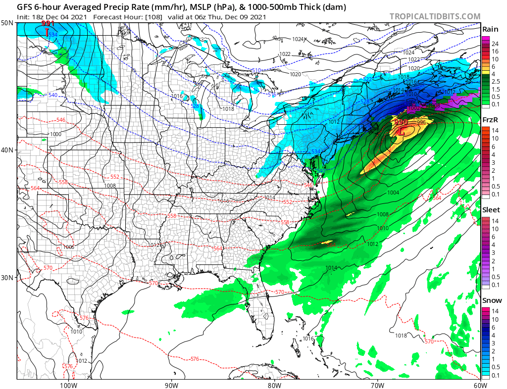
A fast moving frontal wave is forecast to pass near the mid-Atlantic during the Tuesday night to Wednesday night periods, bringing precipitation to the Ohio River Valley and the Mid Atlantic. Model guidance that meteorologists use to aide in their forecasting are suggesting a colder solution, which could yield more snow than initially expected in the Mid Atlantic and eventually the northeast. Precipitation would peak later Wednesday into Thursday before clearing the northeast by Friday. Seasonably cold air will filter into the northeast behind the departing storm in time for the weekend.


It is still too soon to know just how much precipitation will fall and where/what precipitation type will fall, but those details will be ironed out in the coming days as more data is digested by computer forecast models and examined by meteorologists.

Primary Sidebar

Sponsored Ad

Search

Latest News

  • After Violent Night, Storms Shift to Ohio and Pennsylvania
  • Preliminary NTSB Report Shows Something other than Turbulence Killed Passenger on New England Flight
  • SEVERE Geomagnetic Storm Alert Issued; Massive Aurora On Display in North America
  • World’s Largest Volcano Quakes; No Tsunami Threat Around Hawaii
  • Impacts from Geomagnetic Storm Expected Thursday through Saturday; Watch Issued
  • Three Quakes Rattle Mid Atlantic Ridge; No East Coast Tsunami Threat
  • Spring 2023 Arrives Today
  • Incident Meteorologists Provide Additional Support at Special All-Hazard Events
About | Careers | Contact | Contests
Terms | Privacy | Ad Choices
Weatherboy is a (R) Registered Trademark of isarithm LLC, All Rights Reserved.
All content herein is Copyright by Isarithm LLC 1997-2022