
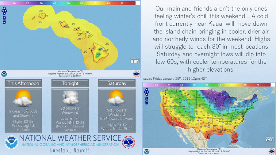
A National Weather Service office issued an infographic to caution residents of its state to bundle up for colder weather. It joins many across the country warning of impending cold air entering the region, with most doing so due to an arriving Polar Plunge from Canada. But this particular National Weather Service is bracing its forecast area to deal with temperatures that will “struggle to reach 80” with overnight lows as cold as the “low 60s.” While most of the United States would welcome such advertised “cold” conditions in the middle of January, the forecast office responsible for such a “chilly” forecast is the National Weather Service in Honolulu, Hawaii.
The meteorologist responsible for the cautionary tale of arriving chilly air joked on Twitter, “Ha! Knew I could get a rise out of a few people…” But for a place known for its warm trade winds and sunny tropical beaches, the cold air will chill many plans in the Aloha States even though they’re not quite up to the standards of cold on the mainland. Most homes in Hawaii have no insulation nor any source of heat. Many take advantage of year-round warmth with open windows January through July, night and day. So when temperatures drop into the low 60’s during these “cold snaps”, locals not accustomed to the drop in temperatures will definitely feel a chill and will need to put on extra layers and blankets.
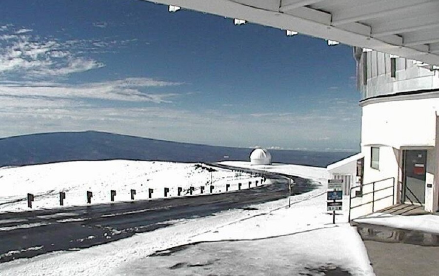
Today, the leading edge of the cold front has passed through the Big Island this morning. Clouds and showers will continue to spread over north and east sections of Maui and the Big Island early today with drier and cooler air moving in from the north reducing clouds and showers on the islands this afternoon. Strong upper level winds will support advisory-level winds over the Big Island summits of Mauna Kea and Mauna Loa today with a Wind Advisory extended into the evening time period. Those summit regions are Hawaii’s coldest, often covered in snow during the winter months, and occasionally other times of the year too. Residents and tourists hoping to check out the spectacular views offered by the summits should especially dress warm; the combination of winds and low temperatures there, which are in the 40’s without the influence of the wind, will make it feel well below freezing. A cool, dry and breezy north to northeast wind will blow in behind the cold front with high and low temperatures falling a few degrees below normal for this time of year across Hawaii. Much drier air will move into the islands from the north.
Over the next few days, chamber of commerce weather will return. Expect mostly sunny weather for most areas this weekend in a very stable atmosphere. An upper level trough passing to the northeast of the state may bring some elevated showers to the north and eastern slopes of the Big Island on Sunday. These cool temperatures will last through Sunday before the temperatures start warming back up early next week. Fair weather conditions remain in the forecast for most islands through the start of the week with a strong high pressure system anchored far to the north of the islands providing dry weather across the region.
