• Skip to primary navigation
  • Skip to main content
  • Skip to primary sidebar

Weatherboy

Weatherboy Weather News, Maps, RADAR, Satellite, and Forecasts.

  • Local
  • Earth Science News
  • RADAR
  • Current Warnings
  • Satellite
  • Current Maps
  • Forecast Maps
  • Video

Polar Plunge Coming

by Weatherboy Team Meteorologist - January 25, 2019

This forecast temperature map shows cold air beginning to sink down from Canada in 72 hours. Image: weatherboy.com


A plunge in temperatures is expected over a large part of the country next week as Polar air invades the United States from Canada. While cold air arriving from Canada is a common occurrence in winter months, this air mass will be especially frigid, with the possibility that low temperature records could break in portions of the upper midwest. While cold air will pour into the U.S. and the weather pattern will be a bit different than what it is this week, the overall pattern remains non-conducive to blockbuster snowstorms for the I-95 corridor in the east. In fact, forecast guidance suggests that this polar air mass will retreat somewhat along the East Coast, allowing for another wet rather than white system for places like Washington, DC, New York City, and Boston.

During the middle of the week, unusually cold air will blanket much of the country. However, the American southwest will see temperatures above normal at that time too. Image: tropicaltidbits.com

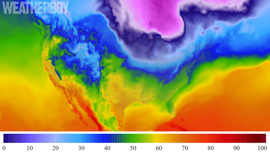
While no blockbuster snowstorms are expected, there could be some light snow events as this cold air settles down over the U.S. next Wednesday.  Wednesday should see the coldest readings from this air mass, with forecast models suggesting temperatures more than 20 degrees below normal for a large part of the country.  The computer forecast models that meteorologists use to aid in their forecasting are conflicted with how things will evolve, with each showing evolving areas of low pressure bringing light to moderate precipitation to portions of the Great Lakes, the southeast, the Mid Atlantic, and the Northeast.  Even with a pattern unfavorable for big snow, there’s a chance accumulating snow could visit Washington, DC, Philadelphia, New York, and Boston as the polar air sinks in next week.


Beyond next week though, extended guidance suggests a moderating trend. Even moderating conditions will produce cold and could produce snow, but as with the short-range, there are no clear signals of a major winter storm in the I-95 anytime soon.

Primary Sidebar

Sponsored Ad

Search

Latest News

  • Tornado Watches, Warnings Issued as Severe Weather Impacts Louisiana, Mississippi, Alabama, & Gerogia
  • After Violent Night, Storms Shift to Ohio and Pennsylvania
  • Preliminary NTSB Report Shows Something other than Turbulence Killed Passenger on New England Flight
  • SEVERE Geomagnetic Storm Alert Issued; Massive Aurora On Display in North America
  • World’s Largest Volcano Quakes; No Tsunami Threat Around Hawaii
  • Impacts from Geomagnetic Storm Expected Thursday through Saturday; Watch Issued
  • Three Quakes Rattle Mid Atlantic Ridge; No East Coast Tsunami Threat
  • Spring 2023 Arrives Today
About | Careers | Contact | Contests
Terms | Privacy | Ad Choices
Weatherboy is a (R) Registered Trademark of isarithm LLC, All Rights Reserved.
All content herein is Copyright by Isarithm LLC 1997-2022