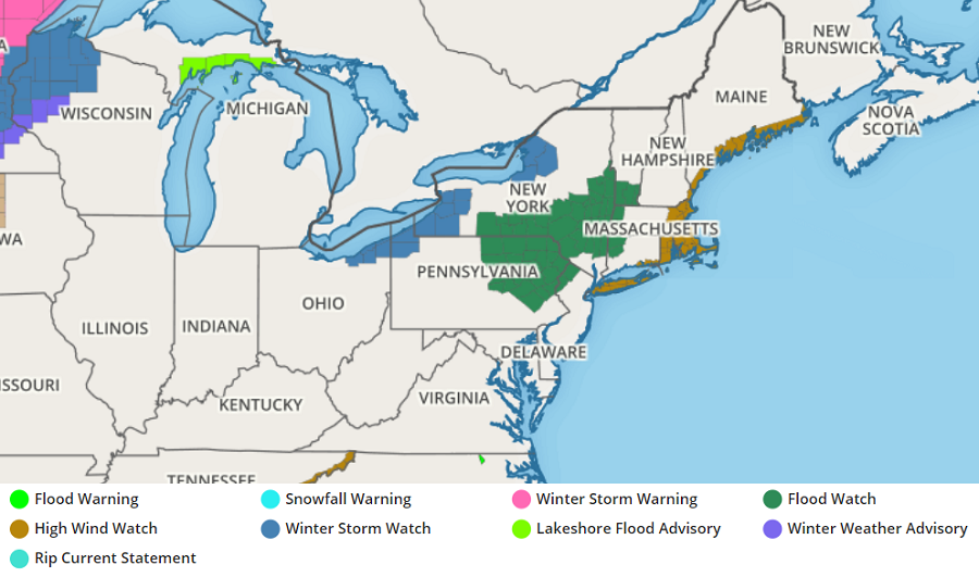
A strong storm system that’ll bring damaging winds, heavy rain, and moderate snow to portions of the Great Lakes, Northeast, and Mid Atlantic is prompting the National Weather Service to issue a variety of weather watches ahead of its arrival. Winter Storm Watches are up in northeastern Ohio, northwestern Pennsylvania, and western Upstate New York for heavy snow. For heavy rain, Flood Watches have been posted for portions of New Jersey, Pennsylvania, New York New Hampshire, Massachusetts, and Connecticut. A High Wind Watch has also been issued for much of the coast of New England and all of Long Island.
While high pressure is building into the Mid Atlantic tonight through tomorrow, it will move off-shore Wednesday night allowing for a storm system to move east in time for Christmas Eve and Christmas Day. A developing low pressure system will lift north into Canada late Thursday through Thursday night, dragging a very strong cold front east across the northeastern United States.
Ahead of this frontal passage, southerly winds will surge mild air from the south into northern New England. This warm air will also bring abundant moisture which will fall as plain rain all the way to the U.S. / Canadian border. Rain will be heavy at times within hours of the frontal passage and it could be substantial enough to create flooding issues, especially in areas with substantial snow pack that will see melting in this storm.
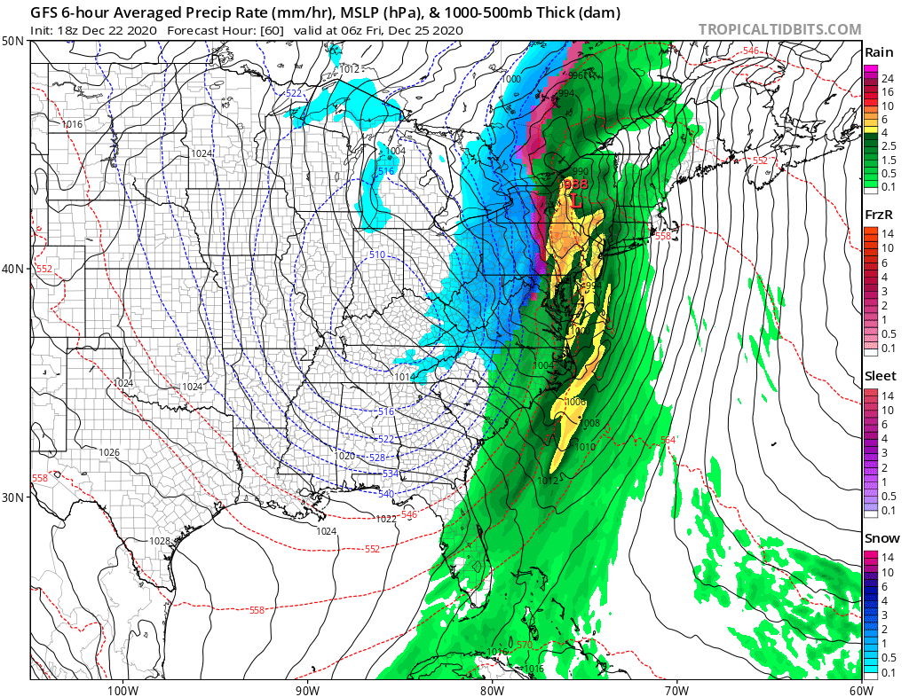
In addition to heavy rain, thunderstorms may also form. Thunderstorms could increase the intensity of downpours; they could also increase the intensity of winds expected to batter the coast.
Winds gusting 40-60 mph or greater are possible, especially at the immediate coast, even without the presence of thunderstorms. The strongest winds will happen Christmas Eve around midnight. Winds could be strong enough to create damage and to cause power outages. People, especially along the coast from Delaware to Maine, should be prepared to deal with the prospect of no power on Christmas Day.
While precipitation will change to snow behind the frontal passage, most of the accumulating snow will be confined to the Great Lakes region and northern New England. No accumulating snow is expected in the Mid Atlantic or the major cities along the I-95 corridor from Washington, DC to Boston.
Fair and dry weather will return back to the region later Christmas Day and Saturday. However, gusty northwest winds blowing across the Great Lakes will likely continue lake effect snow bands in typical, isolated areas there.
