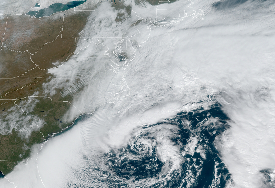
A potent, intensifying storm off the U.S. East Coast is producing a variety of weather hazards today into tomorrow; strong winds, coastal flooding, and even some ice and snow are among the threats it is producing. The coastal low deepened last night and will continue to gradually intensify throughout the day today as it lifts to the north and east.
It was cold enough to produce some light snow across portions of New Jersey and Long Island earlier today. More wintry weather could return as cold air wraps on the back-side of the storm.
While precipitation isn’t heavy, the winds have been strong. Winds today are stronger than yesterday’s with gusty northeast winds from 25 to 30 mph possible, and higher gusts from 45 to 50 mph in the Wind Advisory areas near and along the coast. Such winds are strong enough to topple tree limbs and wires, setting the stage for power outages, especially at coastal areas where winds will be the strongest.
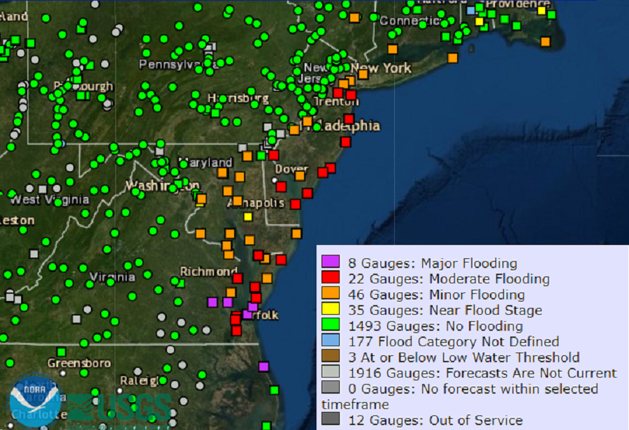
Also impacting the coast is moderate to major coastal flooding. Portions of the Jersey Shore and Delaware beaches will be hit hardest by coastal flood threats. These threats will continue into tomorrow before tapering off.

Later tonight, precipitation will begin to push further inland. As this happens, the National Weather Service expects some freezing drizzle to be on the leading edge of the precipitation shield. While thick ice isn’t expected, a light glaze is expected in portions of the southern Poconos which would produce hazardous travel conditions, especially on untreated surfaces. As the low pressure system pulls east and north tomorrow, cold air will wrap in from the west, switching any ice or light liquid precipitation to snow, especially over northeastern Pennsylvania, northern New Jersey, and southeastern Upstate New York. Because of the threat of wintry weather, the National Weather Service has issued Winter Weather Advisories for those areas. While light accumulations are possible as far south as northern New Jersey, heavier snow is more likely over interior portions of New England where several inches of snow could fall tomorrow into tomorrow night.
Temperatures Sunday night will be in the 30s with areas east of I-95 above freezing and areas west generally below freezing. Monday’s highs should be in the mid 30s to mid 40s along the coast of the Mid Atlantic, producing a chilly Monday for many.
