The skies over Arizona have cleared, but the state’s rivers have not. Days after an atmospheric river soaked the state, dam releases sent the Salt, Verde and Gila rivers through the Phoenix area at levels not seen in decades. Flood warnings remained in effect Thursday from the Valley to the Little Colorado River in northern Arizona.
“Major waterways such as the Salt and Gila rivers will continue to experience high volumes flows through at least the weekend due to dam releases,” the National Weather Service office in Phoenix said in its forecast discussion.
Salt River Project, which runs the reservoirs on the Salt and Verde, said it is the biggest flood on those rivers since 1993, 12News reported. Tempe Town Lake, normally a calm spot for paddlers, has turned into a rushing river.
Rivers at Levels Not Seen Since 1993
SRP said releases from Bartlett Dam on the Verde and Stewart Mountain Dam on the Salt had increased to about 54,000 cubic feet per second, or about 403,000 gallons per second, the utility said Nov. 1. SRP said October and November inflows on the Verde were likely the highest since 1972, roughly eight times the average.
By Wednesday, 12News reported, flows over Granite Reef Dam had dropped to about 20,000 cubic feet per second, or about 149,000 gallons a second, after peaking above 50,000.
Bo Svoma, principal climate scientist and meteorologist at SRP, told 12News the flooding came from “a really impressive atmospheric river event.” He said about 3 inches of rain fell, averaged over the watershed, in 24 hours.
“It could be dangerous or deadly, without a doubt,” Svoma said. “But it’s also very beneficial in the desert.”
The Phoenix office said on social media Wednesday night that “multiple Flood Warnings remain in effect for portions of the Verde, Salt & Gila Rivers” and that “upstream dam releases continue.”
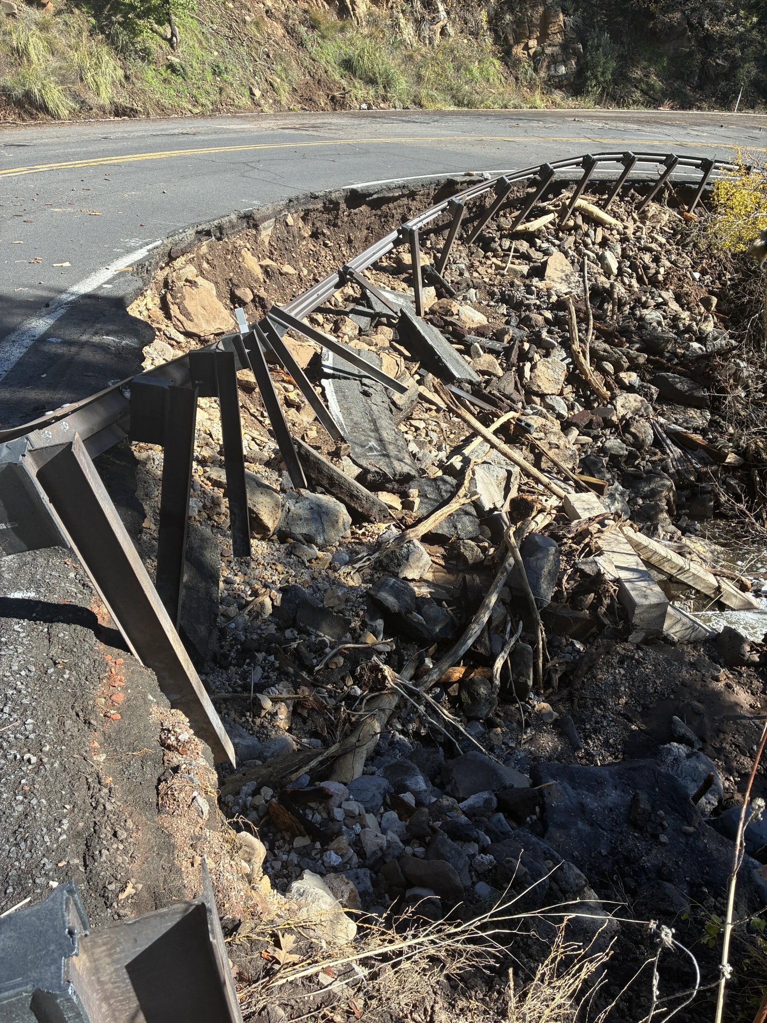
Image: Arizona Department of Transportation
Credit: Arizona Department of Transportation
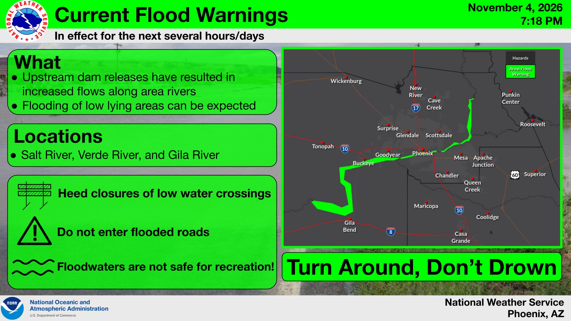
The weather service warnings outline how far the water reaches. One warning, in effect until 2 p.m. MST Saturday, covers the Salt and Gila rivers below Tempe Town Lake and Granite Reef Dam. It said the Gila near Old U.S. 80 was running about 27,000 cubic feet per second. Places in that warning include Goodyear, Liberty, Arlington, Painted Rock Dam and the Phoenix Raceway area.
A separate warning for the Salt River below Tempe Town Lake through Phoenix, Laveen and Avondale ran until 8 p.m. MST Thursday. It described flows of 5,000 to 10,000 cubic feet per second.
On the Verde below Bartlett Dam, the weather service said flows of about 16,000 cubic feet per second affected Rio Verde and Fort McDowell. Near Granite Reef, about 15,000 cubic feet per second had flooded the McKellips Road crossing.
Tempe Town Lake Closed
Tempe closed Tempe Town Lake to all on-water recreation, 12News reported. A man was lifted from a tree by helicopter Monday about a mile east of the lake.
“It is very fast-moving water, and the dam is the most dangerous part, because there’s an undertow,” senior park ranger Alicia Fields told the station. Fields said rangers had also rescued beavers and muskrats.
SRP and local officials warned that roads crossing the riverbeds are closed while releases continue. SRP told drivers to check AZ511.com for current closures.
Emergency Declarations
Gov. Katie Hobbs declared a statewide emergency Nov. 2 and released $200,000 in emergency funds.
“I am issuing this emergency declaration to ensure our local authorities have the resources they need to clear roads, repair infrastructure, and help displaced residents,” Hobbs said in a statement.
Maricopa County declared its own emergency, in part because of flooding in the Rio Verde Foothills, KJZZ reported.
In Flagstaff, Mayor Becky Daggett signed an emergency declaration Nov. 2, the Arizona Daily Sun reported. Two people were found dead in the city. One was found Monday morning after falling into fast-moving water Sunday. The second was found Monday afternoon, and officials are investigating whether that death was weather-related.
Oak Creek Canyon Still Closed
The storm hit the red-rock country near Sedona hard. The Associated Press reported evacuations near Oak Creek on Nov. 1 as the creek rose.
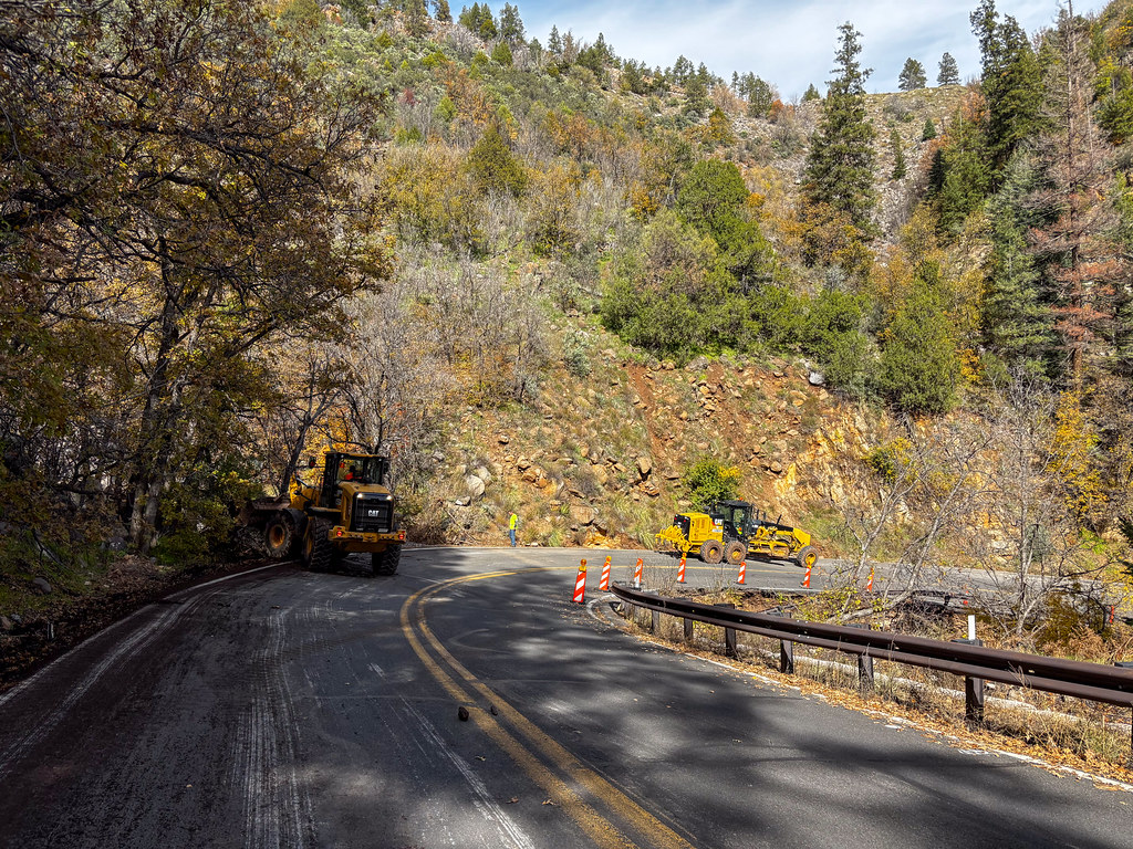
State Route 89A through Oak Creek Canyon, the scenic highway between Sedona and Flagstaff, remained closed Thursday. In a post Wednesday afternoon, ADOT said crews “continue to clear boulders, mud and fallen trees and are now making roadway repairs.”
“The highway remains closed. There is no estimated time for completion,” the agency said.
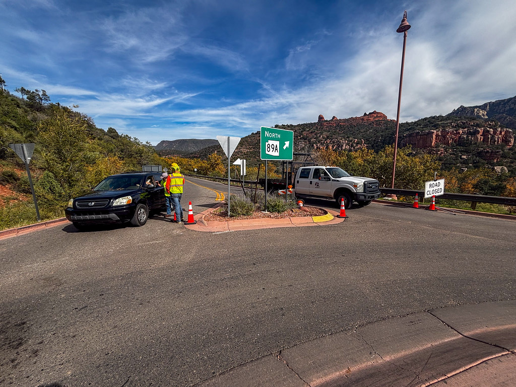
Photos ADOT posted Tuesday show excavators and other heavy equipment working on the narrow canyon road. They also show road-closed barricades and crews stationed at the closure near the “North 89A” sign. Drivers between Sedona and Flagstaff have to use other routes while the work continues.
Little Colorado River Still Rising in Places
In northern Arizona, the weather service office in Flagstaff kept a flood warning for the Little Colorado River from Winslow to Leupp until 8 p.m. MST Thursday. The river at Winslow was 18.7 feet at 7 p.m. Wednesday, just below its 19-foot flood stage. Forecasters said flooding remained a threat downstream near Birdsprings. The warning area includes Leupp, Birdsprings, Sunrise, Bushman Acres, Homolovi State Park and Clear Creek Reservoir.
A separate warning covered Moenkopi Wash near Tuba City. It was at 28.04 feet, above its 27-foot flood stage, with the warning in effect until 7 p.m. MST Thursday.
“Despite the dry forecast, a few instances of flooding continue,” the Flagstaff office said in its forecast discussion.
A Dry Stretch Ahead
The weather is now on the side of recovery crews. The Phoenix office expects dry weather through the middle of next week. ABC15 forecast Valley highs in the upper 70s warming into the low 80s. The station also noted a lake wind advisory for Lake Havasu and the Lake Mohave area. AccuWeather said the flood-weary Southwest should get a break from major storms through mid-November.
The rivers will take longer to calm down. As long as reservoirs upstream are still releasing water, the Salt and Gila will keep running high through the metro area. Officials urged people to stay out of the riverbeds and away from fast water.
