As North America moves deeper into 2020’s Hurricane Season, activity continues in the tropics. While Tropical Storm Dolly has weakened to a tropical depression this morning, several storms are showing organization in the Pacific and new tropical cyclones could be forming there soon.
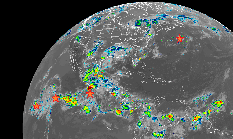
Once the third earliest “D” storm on record, Dolly has weakened to a tropical depression with maximum sustained winds of only 35 mph. The with higher gusts. Continued weakening is forecast as Dolly moves
over colder waters, and the system is expected to become post-tropical later today, according to the National Hurricane Center. Beyond today, the system should completely dissipate sometime tomorrow. With Dolly fading away, the Atlantic will become quiet for a bit with no tropical cyclone formations expected over the next five days.
However, in the Pacific, at least three systems are taking shape with a possible fourth on the way; in addition, the National Hurricane Center believe two will become a tropical cyclone this week. One system is located about 1,700 miles southwest of the southern tip of the Baja California peninsula; another is several hundred miles southwest of the same tip, and the third is located a few hundred miles south-southwest of the Gulf of Tehuantepec. The fourth possible system is also located near the Gulf of Tehuantepec but the other storm will need to exit the area for this newer one to take shape.
While two tropical cyclones are expected to form here over the next 5 days, none of them are expected to impact any landmass in the immediate future. Both high-probability storm systems are forecast to move over open waters of the Pacific between the North American coast and Hawaii.
