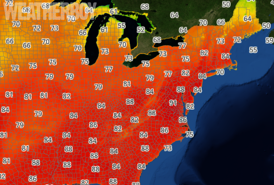
A weather pattern more typical of late June than early May will produce hot conditions in portions of the Mid Atlantic for the balance of the week. Temperatures will flirt with 90 degrees in portions of Virginia, Maryland, and New Jersey on Wednesday and Thursday, with readings in the high 80’s expected in portions of Pennsylvania and New York.
A Bermuda High pressure remains anchored off the Southeast US coast; it’ll stay there through the end of the week. Southwest flow around this high will bring an increasingly hot and humid airmass into the northeast. A thermal trough is forecast to set up along the Applachian Mountains on Thursday afternoon,. With some shortwave energy moving into the region associated with low pressure passing well north of the area, some showers and thunderstorms could develop in this area on Thursday afternoon and Thursday night, north and west of the coastal plain.
On Friday, a cold front is forecast to push through the Great Lakes and Ohio Valley, eventually making it to the coast by late night. More showers and storms will develop around this frontal passage, bringing some relief to the early taste of summertime heat. While highs will be 5-15 degrees colder on Saturday, temperatures will still be running 5-7 degrees above normal.
Another blast of heat is expected later next week as yet another Bermuda High builds along the US East coast.