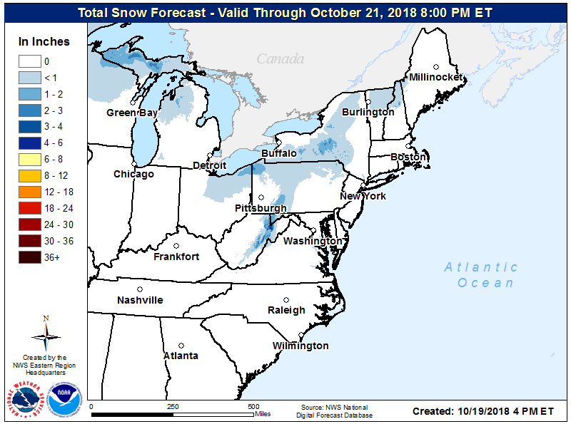
Some early season snow is expected to visit portions of the eastern U.S. this weekend. While snowflakes are expected to fly as far south and east as New Jersey, any accumulating snow will be confined to the higher elevations of West Virginia, central and western Pennsylvania, eastern Ohio, and southern central Upstate New York. As much as 3-4″ of snow could fall in portions of West Virginia by Sunday morning.
A potent front is forecast to move through the Northeast from from Saturday morning through Saturday afternoon with additional scattered rain showers falling across a broad area from the Great Lakes to Northern Mid Atlantic to New England. Temperatures won`t move much at all on Saturday due to increasing clouds and cold air advection. A large deepening trough moving through the Great Lakes Saturday night will trek through the northeast through Sunday. This will usher in a taste of winter Saturday Night into Sunday morning. The accompanying front will coincide with blustery winds and scattered showers. The showers will fall in the form of snow from Ohio to New Jersey, creating reduced visibility at times. However, while flakes may fly as far away as the Garden State, accumulations should be confined to higher elevations of the northeast and northeastern Ohio. It doesn’t take much snow to make for hazardous conditions; travel could become tricky in the higher elevations of the Allegheny Plateau into the Laurel Highlands, along/west of US-219.
While the snow won’t reach everywhere, winter-like temperatures will extend across a broad area. With gusty northwest winds, wind chills late Saturday into Sunday will make it feel more like early December than late October.
With high pressure building in behind this weekend winter event, conditions will improve Sunday night into Monday throughout the northeast.
