
An earthquake swarm continues on Mauna Loa, known as the world’s largest active volcano. While nearby smaller Kilauea Volcano is erupting, Mauna Loa is not yet at this time. But that could change with time.
Beginning at 2:30 am HT on March 29, 2021, the U.S. Geological Survey’s (USGS) Hawaiian Volcano Observatory (HVO) recorded over 130 earthquakes beneath the northwest side of Mauna Loa’s summit, about 26 miles west northwest of the town of Volcano, Hawaii. According to HVO, most of these earthquakes are occurring in a cluster about 1 mile wide and 3.5–5 miles below the surface.
The swarm continues this morning, with a 2.6 earthquake recorded in Pahala at 2:03 am HT.
The largest event in the sequence, so far, was a magnitude-2.7 earthquake, with the bulk of the events being less than magnitude-2. Only one event was reported felt by a resident and was described as weak shaking with a maximum Intensity of II on the Modified Mercalli Intensity Scale.
The HVO says that clustering of shallow earthquakes in this region does not mean an eruption is imminent. In a statement released by USGS, scientists there said, “HVO has recorded shallow earthquakes in this area for many decades across several eruptive cycles at both Kīlauea and Mauna Loa. These earthquakes may result from changes in the magma storage system and/or may be part of normal re-adjustments of the volcano due to changing stresses within it. Other monitoring data streams for Mauna Loa and Kīlauea, including ground deformation, gas, and imagery, show no significant changes in activity.”
While there are no signs of an imminent eruption, USGS wants people prepared for the possibility of an eruption here. Earlier this month USGS cautioned, “While an eruption of Mauna Loa is not imminent, now is the time to revisit personal eruption plans. Similar to preparing for hurricane season, having an eruption plan in advance helps during an emergency.”
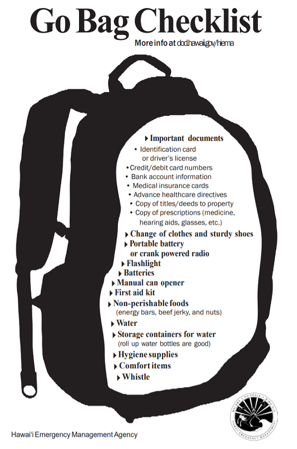
With another eruption on Mauna Loa inevitable, although the timing is not yet defined, the USGS is urging people on Hawaii to have a personal response plan, prepare a “go bag”, and determine what one would do in the event of an eruption at different times of the day or week.
“The most important thing you can do is to have a personal response plan,” says the USGS. Document what you’d do when a volcano erupts and make sure your family and friends are aware of what that plan is.
USGS suggests getting a “go bag” in order. “Nowadays, people pack “go” bags containing essential items in case you have to leave your house under an evacuation order. You may want to include important documents, like your birth certificate, deeds, legal papers, and medications.”
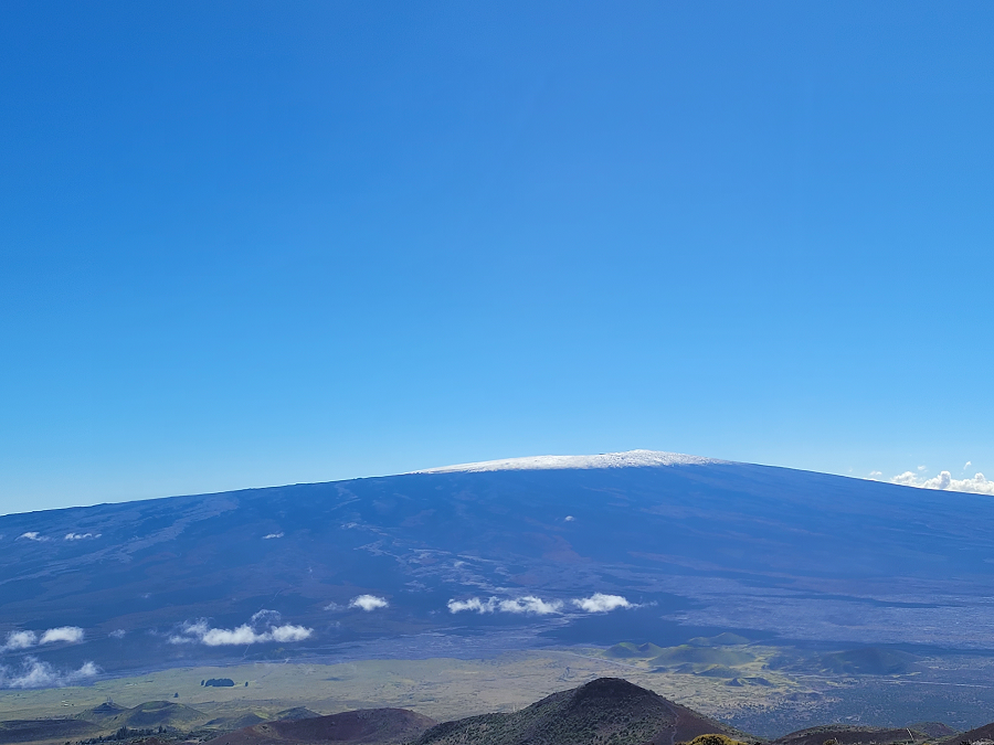
Mauna Loa is considered the largest active volcano on Earth, rising to 13,681 feet above sea level. Mauna Loa rises up from the ocean floor of the Central Pacific at a depth of about 3 miles. Because of the volcano’s significant mass, the ocean floor directly beneath Mauna Loa is depressed by another 5 miles. According to USGS, this places Mauna Loa’s summit about 56,000 feet above its base; the enormous volcano covers half of the island of Hawaii, also known simply as the “Big Island of Hawaii.”
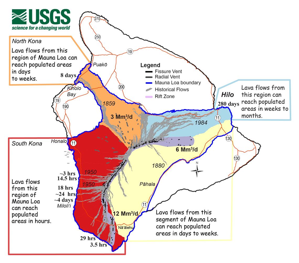
Mauna Loa eruptions tend to produce voluminous, fast-moving lava flows that can impact communities on the east and west sides of the Big Island from Kona to Hilo. Since the 1850s, Hilo in eastern Hawaii has been threatened by 7 Mauna Loa lava flows. On the south and west sides of the island, Mauna Loa lava flows have reached the coast there 8 times: in 1859, 1868, 1887, 1926, 1919, and three times in 1950.
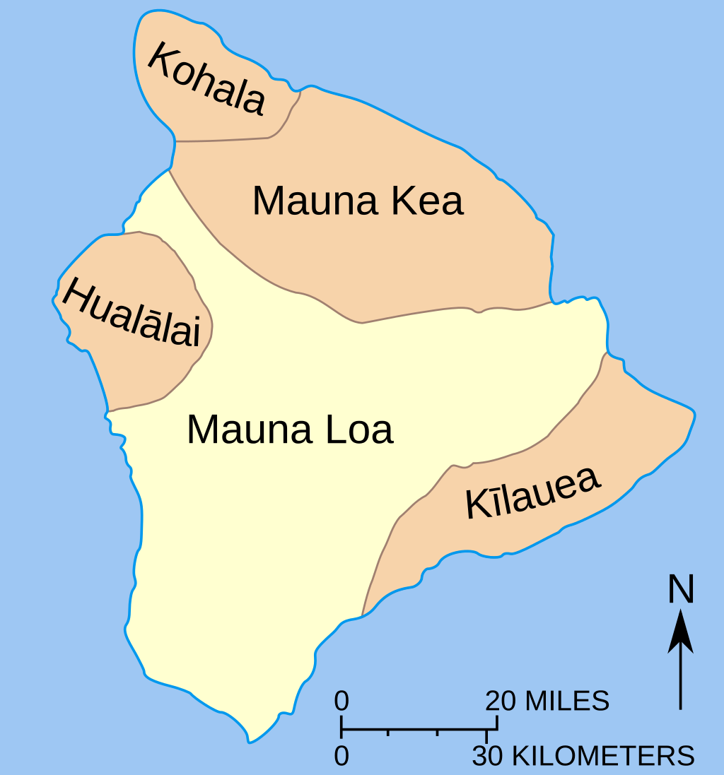
Mauna Loa is one of 5 volcanoes that make up Hawaii’s Big Island. The oldest volcano on Hawaii Island is Kohala, which is more than one million years old. Kilauea is the youngest, at an estimated 300,000-600,000 years old. Mauna Loa is the second youngest volcano on the island, estimated to be about 700,000 years old.
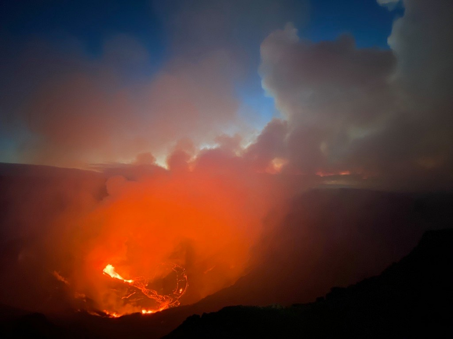
After being quiet for nearly 2 years, Kilauea began erupting again in December. While lava is erupting on the surface at this volcano, it is contained within a lava lake deep inside Kilauea’s caldera. Lava is not threatening any community at this time; other than its glow reflected in the night sky, lava is not visible from viewing areas within Hawaii Volcanoes National Park at this time.
HVO continues to closely monitor geologic changes, seismicity, deformation, and gas emissions at Mauna Loa and Kīlauea volcanoes. According to the USGS, HVO will issue additional messages and alert level changes as warranted by changing activity.
