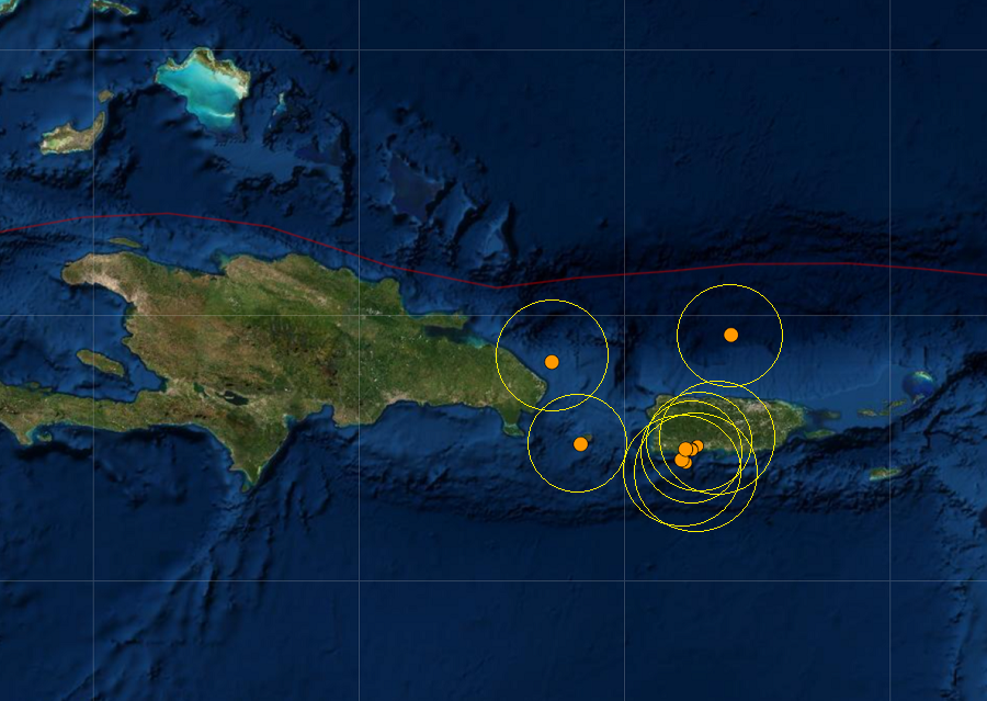
Nine earthquakes ranging from magnitude 2.5 to 3.5 have struck around Puerto Rico and the Dominican Republic over the last 24 hours; there was also a 10th earthquake just under a 2.5 magnitude. While an ongoing series of earthquakes continue to rattle the area, the earthquakes haven’t been strong enough to create much damage and none have been strong enough to generate a tsunami; as such, there is no risk of tsunami to the U.S. East Coast, Puerto Rico, or the U.S. Virgin Islands.
The strongest earthquake, a 3.6 magnitude event, struck 48 miles south-southeast of Punta Cana, Dominican Republic. That earthquake had a depth of roughly 23 miles.
Six weaker earthquakes hit Puerto Rico near Guanica, Ensenada, Indios, and Playa on the southwest coast. These earthquakes are close to the epicenter of a strong earthquake that hit in January 2020; these new quakes are likely continued aftershocks from that event. That 6.4 created extensive damage in Puerto Rico, including widespread power failures across much of the island. An earthquake swarm started here in December 2019 and unrest has continued since.
The strongest quake today in Puerto Rico was rated a 3.3 magnitude event.
These earthquakes are occurring near the northern edge of the Caribbean Plate, a mostly oceanic tectonic plate underlying Central America and the Caribbean Sea off of the north coast of South America. The Caribbean Plate borders the North American Plate, the South American Plate, the Nazca Plate, and the Cocos Plate. The borders of these plates are home to ongoing seismic activity, including frequent earthquakes, occasional tsunamis, and sometimes even volcanic eruptions.
