The National Hurricane Center and the National Weather Service continue to track a large area of disturbed weather located off of the U.S. East Coast. Within this broad area of disturbed weather, it appears two systems will form, with one possibly becoming a tropical cyclone. They could also combine into one non-tropical cyclone. While some kind of storm formation is likely, it isn’t yet clear how land will be impacted in the Mid Atlantic and New England regions.
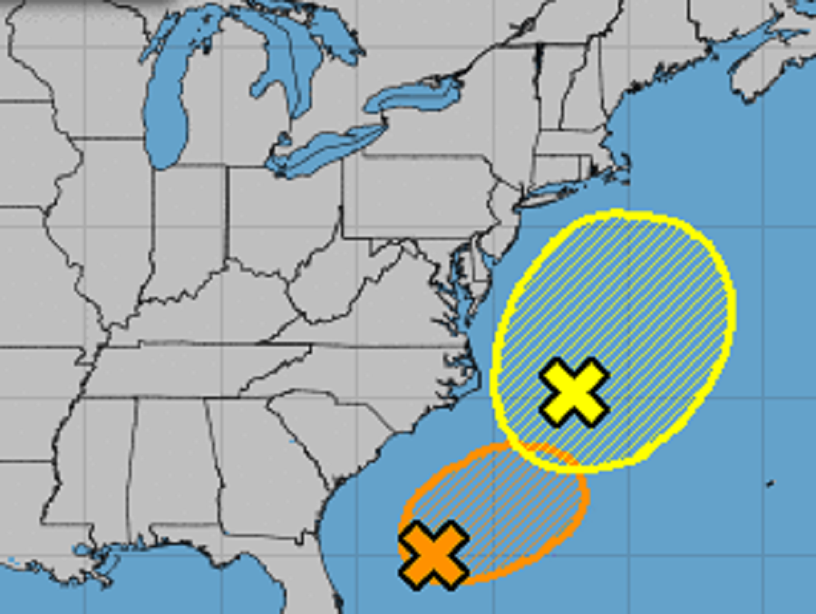
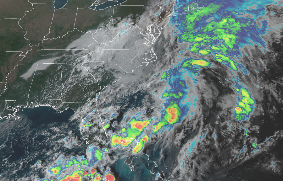
The first system of concern is closest to Florida today. Recent satellite wind data indicate that a small area of low pressure has formed in association with an area of disturbed weather located a few hundred miles southeast of Charleston, South Carolina. The system is producing winds to near tropical storm strength and the associated thunderstorm activity has recently shown some signs of organization. According to the National Hurricane Center, although upper-level winds, are not particularly favorable for additional development, only a small increase in organization could result in the formation of a tropical depression or storm later today or tonight. On Wednesday, the system is forecast to merge with the low off the east coast of the United States, and further development is not anticipated after that time. For now, the National Hurricane Center believes there’s a 40% chance that this system will develop into a tropical cyclone in the next day.
Further up the coast, cloudiness and showers located off the mid-Atlantic coast of the United States are associated with a frontal boundary and a broad, non-tropical area of low pressure. This system is forecast to drift northward or northeastward and deepen as a non-tropical low off the east coast of the United States during the next day or so. According to the National Hurricane Center, this system could acquire some subtropical characteristics by the end of the week while it remains off the east coast of the United States. This system will also likely absorb the moisture and energy associated with the first system.
Regardless of any development, this combined system is expected to bring strong winds, coastal flooding, and rough surf to portions of the Mid Atlantic and northeastern United States coast through late week. Areas closest to the coast will see the best chance of rain and wind. For now, it appears the worst conditions will be over eastern Long Island and southeastern New England; there, heavy rain and tropical storm force wind gusts will be possible.
Because there will be weak steering currents around this system this week, it will be slow to move on. As such, a prolonged northeasterly fetch from this system will create coastal beach erosion, rip currents, and even coastal flooding far from where rain will fall.
For now, it appears the center of circulation of this storm will remain off-shore, keeping most rain off-shore too. Some rain will extend inland but how far inland remains in question. The afternoon computer model forecast guidance suggests there will be little rain or wind north and west of the I-95 corridor in the Mid Atlantic and New England area. But from I-95 and to the coast here, gusty showers are likely over several days this week.
A cold front will move through the eastern U.S. this weekend, pushing this system away from the coast and out to sea by Sunday. Once the front clears the coast, high pressure will build in, bringing dry conditions, fair skies, and relaxed winds.
