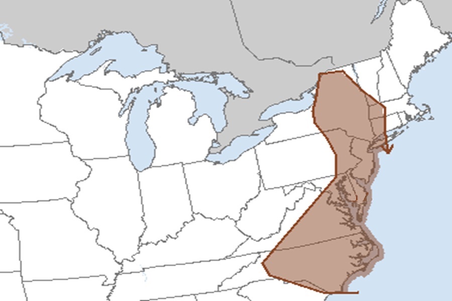
According to the National Weather Service’s Storm Prediction Center, there is an elevated risk of gusty, potentially damaging winds from thunderstorms moving through portions of the East on Thursday. The risk zone extends from eastern New York and Pennsylvania into New Jersey, Delaware, Maryland, Virginia, and North Carolina.
Parts of this area were rocked by soaking storms and tornadic cells on Wednesday. The National Weather Service had Tornado Warnings up at one point across portions of Maryland, Delaware, and New Jersey.
While a severe thunderstorm could always twist up a tornado, the National Weather Service believes there’s a better chance of straight-line wind damage from storms on Thursday.
According to the Storm Prediction Center, forecast soundings suggest convective temperatures will be breached by the afternoon hours with scattered thunderstorms expected to evolve along and ahead of the surging cold front sweeping through the region.
“While deep-layer shear is not expected to be particularly strong, mid-level flow should be sufficient for some organization and gusty winds are the primary risk with storms by mid day,” warns the National Weather Service in their latest Convective Outlook.
Along with gusty winds, there can also be flash flood-causing heavy downpours.