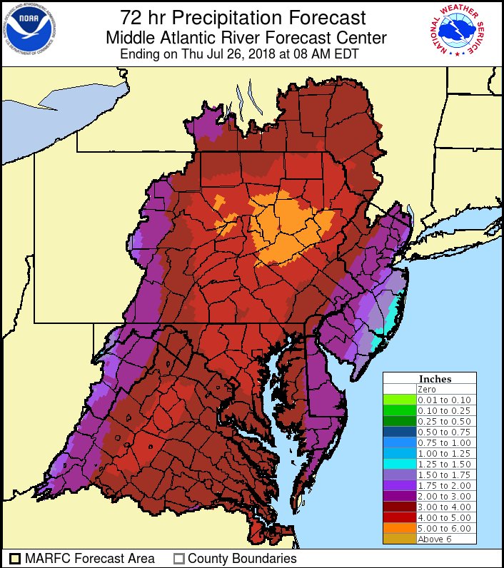
The National Weather Service is warning residents in the Mid Atlantic to prepare for the possibility of epic flooding over the next several days. In an alert from the National Weather Service Mid Atlantic River Forecast Center (MARFC) office, they write, “a potentially dangerous, even life threatening, situation is setting up for much of the Mid-Atlantic. After a weekend of 2-7+” rain for much of the Mid-Atlantic, an additional 3-5+” of rain is expected over the next 3 days.” In a map they released with the alert, it shows almost the entire MARFC area of responsibility getting more than 2″ of rain over the next 72 hours. The only area to see under 1.5″ of rain is along the Jersey Shore communities of southern Monmouth, Ocean, Burlington, and Atlantic counties.
Coast over the next week. Image: NWS
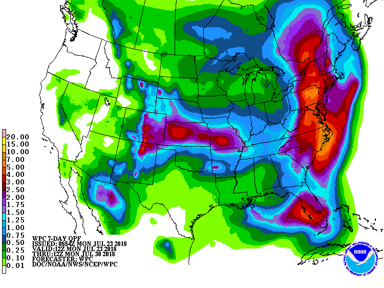
A wet weather pattern will not only bring soaking rains to this region over the next 72 hours, but over much of the East Coast over the next 7 days. Streaks of heavy, occasionally torrential rain will continue to move northward, and those locations that get hit frequently by these tropical showers will see the heaviest three-day totals. As such, the flood threat remains extremely high in the Mid Atlantic over the next three days.
Beyond this three day soaking period, the weather pattern will continue to allow for heavy rain and thunder showers to move up along the coast from south Florida to western Maine. Because many of these cells will dump rain over and over in the same area due to weak steering currents, the flood threat will last throughout the week into next weekend.
The National Weather Service warns people: “turn around, don’t drown; never drive through flooded roads.” Last year, 116 people died in flash floods and river floods in the US and the National Weather Service doesn’t want the 2018 death toll to grow.
