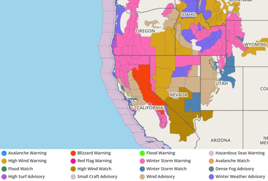
An epic, paralyzing blizzard is forecast to dump more than 10 feet of snow across portions of the U.S. west as heavy rain at lower elevations and strong winds at all elevations whip the region. A winter storm is impact the West Coast today and into tomorrow, creating extraordinarily heavy mountain snow that will affect many passes.
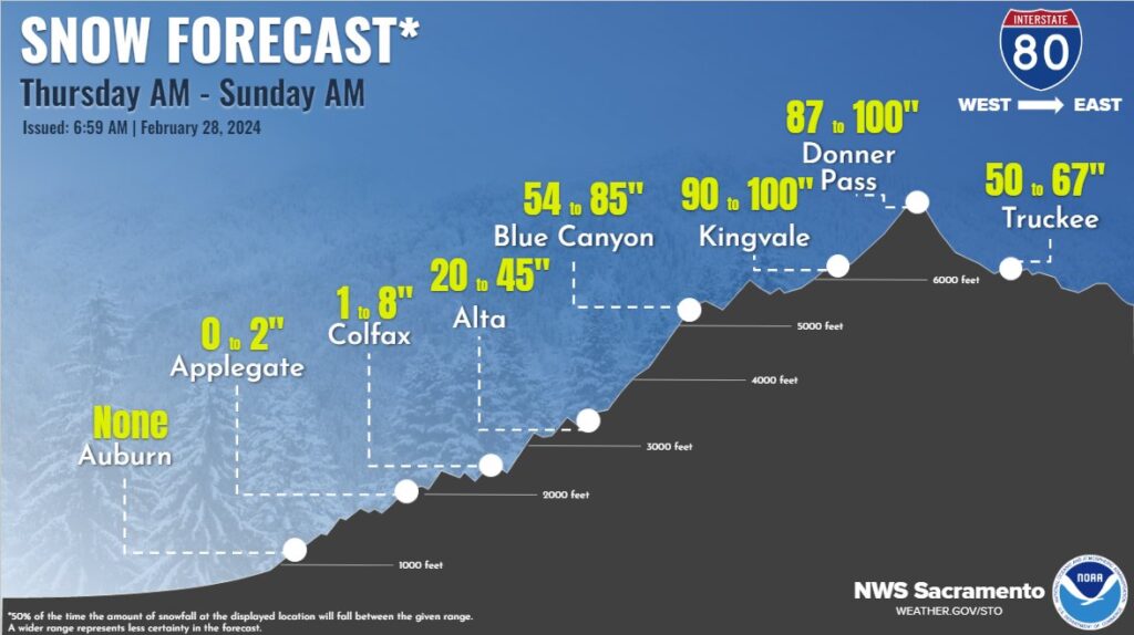
According to the National Weather Service, multiple feet of snow are likely for higher elevations, especially above 5,000 feet, including many Cascade and Sierra Nevada Mountain passes. Extremely heavy snow rates surpassing 3 inches per hour are likely, making travel difficult if not impossible.
The storm will produce blizzard conditions in the Sierra Nevada Mountains. Strong winds will cause significant blowing and drifting snow and whiteout conditions, making travel impossible in the Sierra Nevada Mountains. According to the National Weather Service, there is a “high” (over 70%) chance of substantial, long-lasting disruptions to daily life in the higher elevations of the Sierra Nevada Mountains Friday-Saturday, where blizzard conditions and 5+ feet of snow are expected.
In addition to the snow, coastal rain will develop over parts of the Pacific Northwest today through Saturday. Coastal rain that developed this morning over parts of California will continue into Saturday.
In addition, a widespread damaging wind event will develop over the Western U.S. Wind gusts of 55+ mph are forecasted across much of the West, particularly across higher elevations and the Intermountain West, where 75+ mph hurricane-force gusts are possible. These winds would likely down trees and power lines, resulting in power outages across affected areas.
As cold air wraps into the system, it’ll lower snow levels Friday into Saturday. As the storm moves south, snow levels will lower into some Northern California and Sierra Nevada Mountain foothill communities. Much colder air is forecast for Saturday, with temperatures 10-20 degrees below normal.