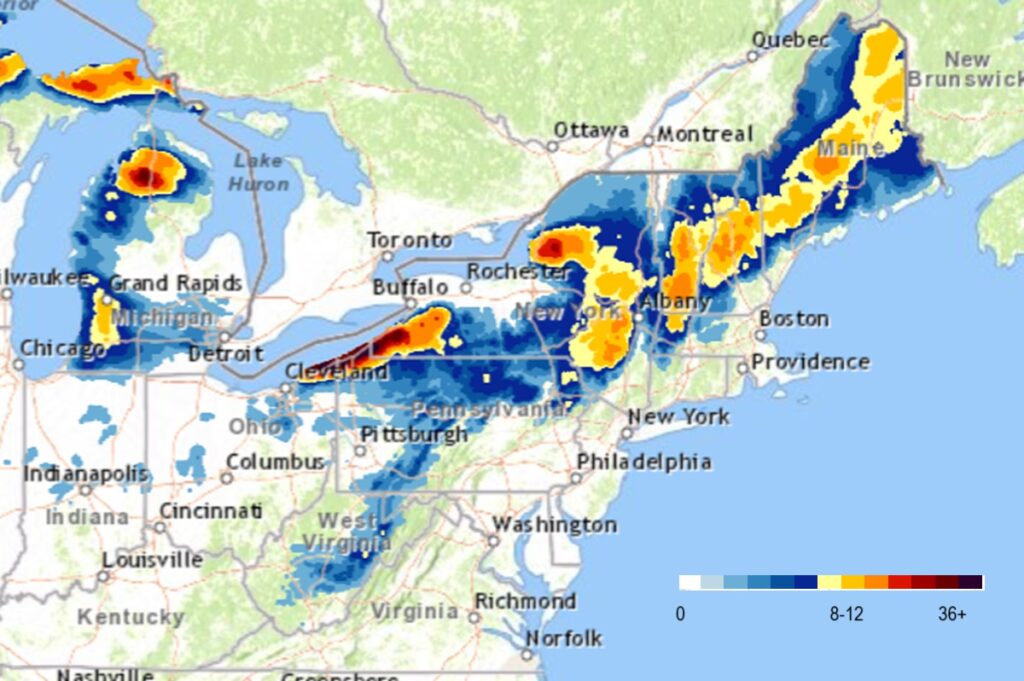
Epic snowfall continues to fall over portions of the northeast thanks to a perfect lake effect snow set-up. Very cold air from Canada is moving over the unseasonably warm Great Lakes, lifting up moisture and depositing it as heavy snow down-wind of the Lakes.
A prolonged and intense lake effect snow event will continue through the end of the weekend east of Lake Erie and Lake Ontario. Some areas will see multiple feet of snow with travel nearly impossible at times within the most intense bands. Winds will become northwest Sunday night, moving lake effect snow to southeast of the lakes with additional light to moderate accumulations possible Monday through Tuesday. Additional snow chances will continue through the rest of next week in and active and cold pattern.
More snow is also expected elsewhere around the Great Lakes. Upper-level troughing over the Upper Midwest/Upper Great Lakes into the Northeast and cold air streaming over the Great Lakes will continue to produce heavy lake-effect snow over the Upper Peninsula of Michigan through Monday. Lighter snowfall will develop over most of the west coast of the Lower Peninsula of Michigan during the time period. However, heavy lake-effect snow will develop over the parts of the northern Lower Peninsula of Michigan near the Traverse City to Gaylord regions. Moreover, heavy lake-effect snow will develop downwind of Lakes Erie and Ontario through Monday.