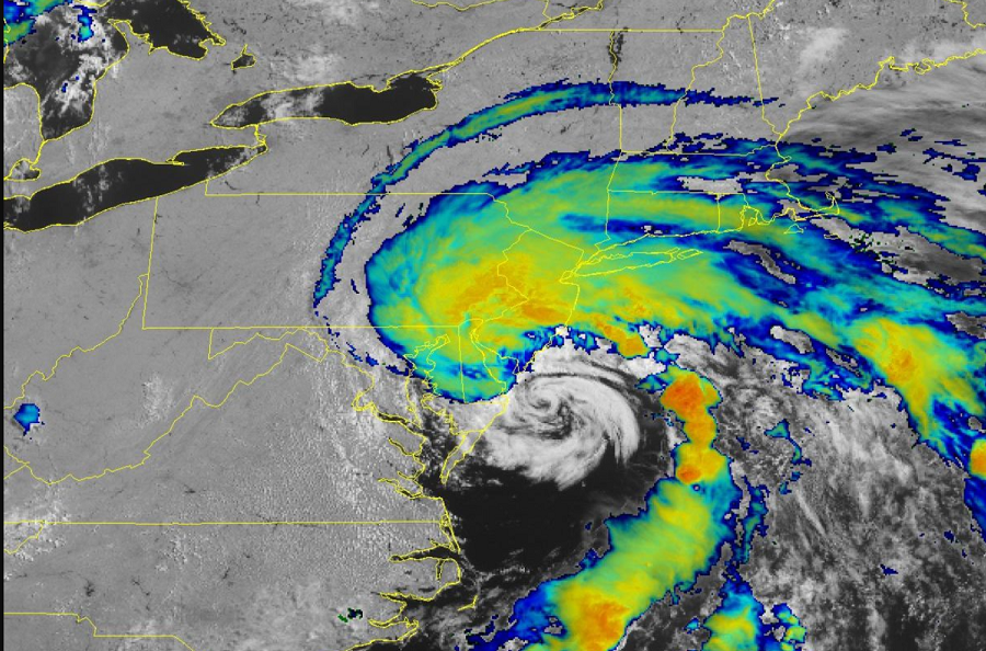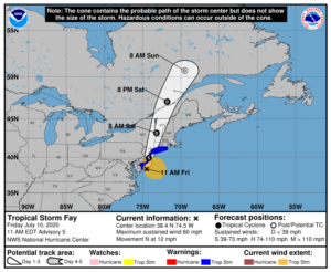
The National Hurricane Center in Miami, Florida says Tropical Storm Fay has intensified, requiring them to extend Tropical Storm Warnings south. A Tropical Storm Warning is now in effect for Fenwick Island, Delaware to Watch Hill, Rhode Island including Long Island and Long Island Sound. The Tropical Storm Warning now includes southern Delaware Bay. This warning means tropical storm conditions are occurring now or are imminent.
As of 11:00 am ET, the center of Tropical Storm Fay was located by an Air Force Reserve Hurricane Hunter aircraft near latitude 38.4 North, longitude 74.5 West. This puts it at 40 miles south-south-east of Cape May, New Jersey and 170 miles due south of New York City. Fay is moving toward the north near 12 mph. Data from hurricane hunter aircraft indicate that the maximum sustained winds have increased to 60 mph with higher gusts. Fay is not expected to gain much additional strength and as such isn’t expected to become a hurricane which happens when maximum sustained winds increase to more than 74 mph. The estimated minimum central pressure has dropped down to 999 mb or 29.50 inches.

Tropical-storm-force winds extend outward up to 140 miles from the center. A Weatherflow station at Lewes, Delaware, recently reported a sustained wind of 40 mph and a wind gust of 50 mph . A National Ocean Service observing site at Lewes recently reported a sustained wind of 40 mph and a wind gust of 49 mph.
Because Fay is more of an asymetric tropical storm and not a circular hurricane, the heaviest rain will fall just north and west of the center of circulation while strong winds will be near and to the east of the center.
Tropical Storm Fay will bring heavy, flooding rains, strong winds, some storm surge flooding, and the threat of tornadoes as it moves north. Fay is expected to produce 2-4″ of rain with isolated maxima of 7 inches along and near the track from Delaware northward into New Jersey, eastern Pennsylvania, southeast New York, and southern New England. The rain may result in flash flooding and urban flooding in areas with poor drainage where the heaviest amounts occur. Fortunately, due to the compact nature and quick forward speed of this system, widespread river flooding is not expected at this time with Fay. Tropical storm conditions will continue to spread northward within the warning area through tonight. The National Hurricane Center says minor coastal flooding is possible in portions of the Tropical Storm Warning area; however, again due to it’s compact nature, a widespread serious storm surge isn’t expected. Isolated tornadoes are possible today across coastal areas of New Jersey, southeast New York, and southern New England. Tornadoes that spin-up in this scenario are usually weak, however, they can still do damage and create injuries.
Tropical Storm Fay is the earliest sixth-storm to ever form in the Atlantic Basin on record. It is also likely to become the first tropical cyclone on record since the 1850s to move into Quebec, Canada.