January 2, 2020 PM update: Note this forecast has changed and this article is outdated. Visit weatherboy.com for more current forecasts.
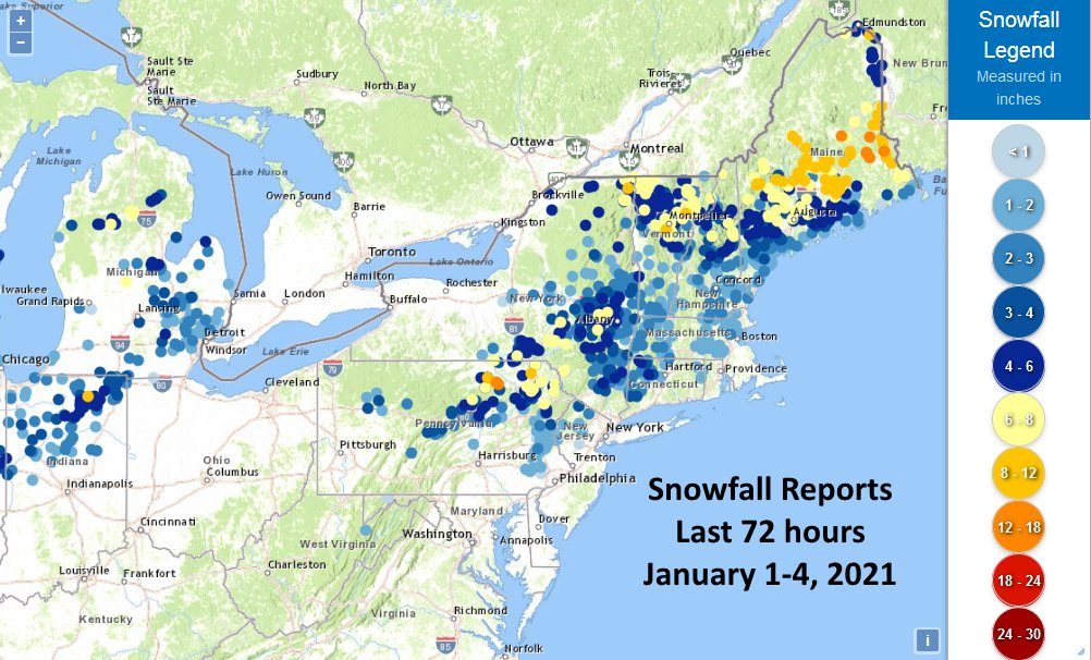
The National Weather Service has compiled snowfall amounts for this storm now that is complete:
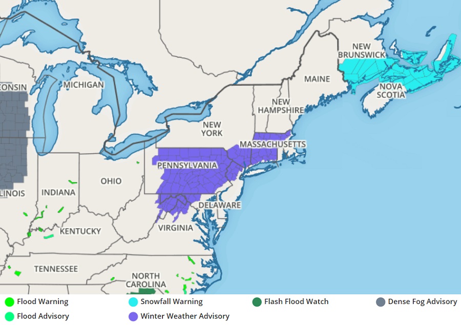
The first snowstorm to impact the Northeast will arrive tomorrow evening; the event, which will linger into Tuesday over northeastern New England, could dump more than a foot of snow in some locations. With snow on the way, the National Weather Service has issued Winter Weather Advisories for portions of New Jersey, Pennsylvania, Maryland, Virginia, West Virginia, New York, Connecticut, and Massachusetts.
While an area of low pressure over the Canadian Maritimes moves out tonight, high pressure is forecast to build from the Great Lakes to New England. This fresh high will allow colder air to settle in over portions of the northeast. As that cold air arrives, another area of low pressure is expected to develop in the Carolinas later tonight. The low is forecast to deepen as it moves over the waters off the Middle Atlantic coast on Sunday and Sunday night. Over time, it’ll eventually head out to sea, but it’ll stall near the Gulf of Maine Monday into Tuesday. It is this system that is expected to bring snowfall to portions of the northeast starting late tomorrow into Monday and Tuesday.
The southern half of the storm system’s impact region will see plain rain, with rain expected in places like New York City, Long Island, southern New Jersey, southeastern Pennsylvania including Philadelphia, and points south and east. Rain will be light to moderate; because heavy rain is not forecast, freshwater flooding is not expected to be much of a concern.
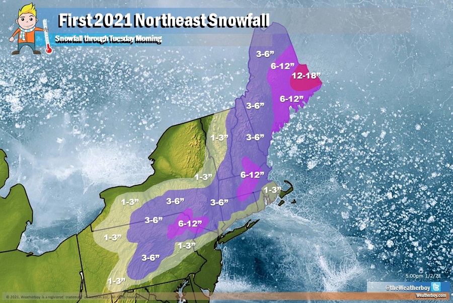
North of there, snow will fall. Snowfall accumulations are expected to be on the light side across portions of Pennsylvania, northern New Jersey, and southern New England, where 1-3″ are expected. However, just inland from the coast, across northeastern Pennsylvania, southern upstate New York, and into much of eastern new England, including the Boston metro area, a few more inches of snow are expected with storm totals of 3-6″ in the forecast there. A few 6-8″ snow amounts are possible in the highest terrain of northeastern Pennsylvania, northwestern New Jersey, and south-central interior New England. However, heavy snow is expected over southeastern Maine where a prolonged period of snow Monday and Tuesday is expected. In this more substantial snow zone in Maine, more than a foot of snow could fall by the time the system wraps up in the coming days.
Motorists are advised to exercise caution when traveling in winter weather conditions, especially on untreated roadways.
