After a soaking, potent rain storm dumped more than 3″ Saturday night onto the Garden State, it looks like New Jersey is in line for additional flooding rains. An area of low pressure will move across the Ohio Valley and into the southern Great Lakes region over the next 12 hours. As the low moves across, it will drag a cold front into the Mid Atlantic on Monday into Monday night.
As the front moves into the Mid Atlantic, a low will form along it and this is likely to enhance precipitation, allowing for heavier rain to fall through the day. While only an inch or so of rain is forecast to fall from this next round of rain, when added to the 3″+ that fell on Saturday night, flood concerns are high. According to the National Weather Service, many rivers, creeks, and streams have been or are currently flooding and even small amounts of heavier rainfall could cause them to spill over once again.
Periods of heavier rain are expected to form during the afternoon and evening hours on Monday, which could make a mess of the PM rush hour after the long holiday weekend. This period of heavy rain will fall as an upper level vorticity maximum moves across the Mid Atlantic at the same time as the upper jet stream crosses the area. Good lift, good moisture convergence, and strong low levels winds will make for a soggy and windy day across the region. With a similar atmospheric setup to the Saturday night event, the storm could wrap up quickly and intensify as it moves through New Jersey. However, unlike the Saturday system, the low will remain over land rather than over the water, which should limit how quickly it deepens.
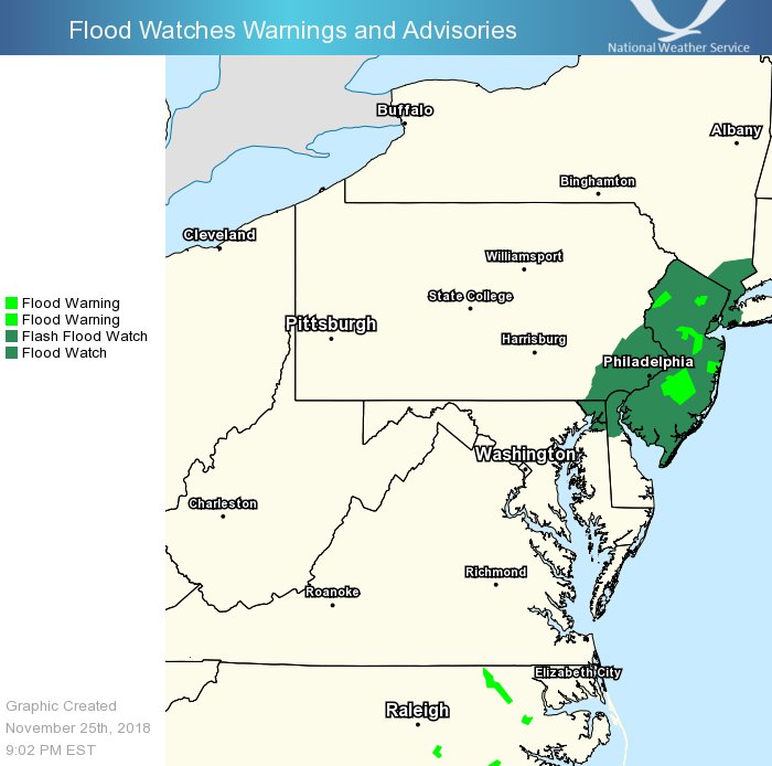
With another round of rain moving through, the National Weather Service has issued flood-related advisories for portions of New Jersey, Pennsylvania, Maryland, Delaware, and New Jersey.
With rising temperatures expected ahead of this system’s arrival tomorrow, precipitation will fall in all liquid form with no threat of ice or snow in the heavily populated I-95 corridor south of New York City. As low pushes away from the region Monday night, some colder air
will filter down in the northwest flow and some dynamic cooling will take place. With this cold air arriving, it may be possible that some rain will change over to snow or a mix of snow and rain at the end of the event late Monday night across the southern Poconos and northwest New Jersey. However, no significant accumulations are expected.
